Winter scene looking out from our front door in Kiltanna.
Childhood memories are mostly of sunny days, but maudlin memories of those Christmases from the late 50s and early 60s still linger. It was so innocent and naïve, in a way, it was as if Christmas hadn’t been invented yet! It was a Christmas of cowboy ‘cap’ guns and other useless ‘purties’ – they seldom lasted longer than a day. We always had a turkey, our own free- range turkey, before it became trendy. We even had a surplus, and I remember my mother sending turkeys by post to her sisters in England! We usually had a Christmas cake from Upton’s in Ballylanders. There was trifle, plum pudding, jelly and custard, the dinner of the year. I never remember drink being in the house. There were never visitors, nor were we encouraged to visit anyone. If the day had been anyway fine, Michael and I were to be found on the road with our hurleys, knuckles blue.
Christmas back then was more about the crib than about Santa. The church was central to the festivities, and the midnight Mass and the Latin were magical. There were no decorations, no Christmas tree and holly hung from the holy pictures. Later, Michael and I usually liberated a Sitka Spruce sapling from a nearby forestry. One year, we brought one from Ballintubber through the fields for fear of detection, having cut it down with a bread knife! Before electricity came to Rapala in 1958, the gloom was amber with the glow from paraffin lamps. We were exceedingly lucky to have had exceptional parents, and so, despite their own strapped circumstances, we were always at the centre of Christmas Day as children. Mam and Dad worked far harder than we then realised to create an experience that modelled what it meant to care for others: with kindness, generosity, consideration and love. Even still, to this day, that tradition continues, and children don’t notice the carefully oiled machine that shudders into life to create the magic of a good Christmas, and hopefully that will never change.
Maeve and Anna visit the crib in Our Lady of Ransom Church in Glenroe.
I remember one Christmas in particular – the winter of ‘62 – ‘63 was long and memorable – it snowed and forgot to stop. It began snowing at Christmas time, and the snow and ice remained on the ground for months. If my memory serves me, we didn’t return to school that year until late March! In the meantime, the snow lay on the ground, and people coped as best they could.
Looking back on it now, we were lucky that, as a family, we were nearly entirely self-sufficient and had no use or need whatsoever for convenience stores or supermarkets! I was a Mass server, and each morning I would get up and walk through the drifted snow to serve Mass in our local Church, nearly two miles away in Glenroe. Mass was in Latin at that time, and both Fr. Carroll, who was the Parish Priest, and the Mass servers faced the altar with their backs to the congregation, and the ten-year-old Mass servers made the responses in Latin. The congregation were silent throughout. The Vatican Council, Vatican II, had been convened at the time by the saintly Pope John XXIII, and great changes were around the corner – but not yet! You know what I always say about change: the only people who welcome it are babies with wet nappies!
I remember those mornings being joined on my trek to the Church by Hanny O’Dwyer, who was an extremely devout and holy woman who had already walked nearly two miles to get to my house. At least two of her brothers were priests in England or Scotland, and she attended Mass daily. That year, she was accompanied some mornings by her sister-in-law, who had recently married her brother, James, who was a farmer in nearby Ballintubber.
I have uncomfortable memories of being embarrassed by a new pair of shoes which had arrived in a parcel full of all kinds of ‘goodies’ from Aunty Mary just before Christmas that year. My mother forced me to wear them on Sundays and when serving Mass. Now in 1963, the problem was that these were a pair of slip-on shoes, and the only people I had ever seen wear slip-on shoes were women. I felt that everyone in the church was looking at my new shiny black shoes. Little did I know that they were the coming fashion and that, for once, I was years ahead of my time!
The most shocking memory I have of that winter was the funeral of a local man. His name was Hayes, and for all I knew, he may have been a relation. He died, and I remember my Dad telling me that the snow drifts were up to the gable end of the farmhouse where he lived in Ballintubber. The neighbours had to shovel the snow away to make a pathway for people to enter the house. I have a vivid memory of the funeral cortege passing our house, and the coffin was being carried on the buckrake at the back of a red tractor. I was shocked at this sight, and I thought it was very disrespectful to the old man who had died. In hindsight, however, it was probably the only practical way that he could have been taken to the Church.
In January 1963, I can still see in my mind’s eye, Mam and Dad and all six of their children looking out the front window as that funeral passed. Later that year, in November, the seventh member of our family, Noreen, arrived hale and hearty, and the world has been a better place since!
John Montague, one of my favourite poets, has a haunting poem called ‘Like Dolmens Round My Childhood’. The poem describes the old people, his neighbours, who lived in a land where ancient beliefs and superstitions still survived. We get the sense that during his childhood, these vulnerable people still believed in myths and magic, curses, and the fierceness of local feuds. Ghosts still roamed the land, in the dark countryside just beyond the reach of the farmhouse lights.
Looking back now, I realise that this was also true of my native place, and I am amazed at the number of old people that I knew and who knew me. These, often vulnerable, saintly people regularly passed my door, or I met them on my journey to and from school each day. People like Josie McGrath, Hanny Kelly and her brother Mick, Hanny O’Dwyer on her way to Mass, Jack Connell, ‘The Cuckoo’, who brought the post, Lew Walsh and his chestnut horse and trap, or his wife who, like Miss Havisham in Great Expectations, scared the life out of us on our way home from school in the evening, as she glared out at us from behind the hedge.
I remember stopping and talking to Syke Meade and his neighbour Bill English, on our way from school, as they leaned against the ditch looking up towards Bawnard. For as long as I knew him, Syke wore a long black overcoat and Wellington boots, whether it was Sunday or Monday, Summer or Winter. He was gifted at hooping hurleys, and Dad always brought him supplies of metal hoops from the discarded packaging from the cheese factory in Mitchelstown. Bill English was a gentle giant of a man, although he had a pronounced limp from an accident in his youth. Dad loved to have him in the yard when the hay was being brought home because of his great strength and height. There are other names too: Tom Lee and his son Mick and daughter Alice, Mick Quane and his daughter Anne, ‘John George’, Joe and Babe Hennessy, Tom and Mick Howard, Josie Tobin and the fierce Mrs McGrath.
I also have fond memories of Joseph Meade, who lived under the road down near The Battery bridge and also of his sister Betty. At that time Joseph worked as a farm labourer with the O’Dwyers, and we would often meet each morning on our way to the creamery in Darrragh. Joseph’s father had one or two cows, and he grazed them each day along the sides of the road, ‘the long acre’ we called it, between his own house and Lew Walshes. No greater example is needed to illustrate the differences that existed between those times and today.
Montague, the great poet of emotion and of place, sums up those long-gone times. I, too, am fascinated by those faded memories and the love of my native place, which has resurfaced as I reminisce. Just like Montague, I too bow to those ‘Gaunt figures of fear and friendliness’, because ‘For years they (have) trespassed on my dreams’.
That myriad cast of characters was part and parcel of the ‘village’ that raised me. And it is only fitting that today a new generation should develop their own customs and new family Christmas traditions for this new age: poring over Smyth’s Catalogues and coping with (multiple) Elves on the Shelf, even trips to Lapland to visit Santa. But budgeting for Santa and tomorrow, and next year, at the kitchen table, is strictly for adults. All children should just feel cared for, excited, and part of the beloved traditions that make up their family’s festive season, being swept along by the ambience and anticipation that only Christmas can bring.
This is a detail from the 1840 historic map showing the sculpted and structured gardens surrounding Knockaderry House, the birthplace of Sophie Peirce, and the nearby Chesterfield House. It was unusual that two ‘Great Houses’ like these would be in such close proximity to each other.
Glenroe, my native place, sits on the border between Limerick and Cork and hurling and athletics were always very strong in the area. In Canon Sheehan’s famous novel, Glenanaar, there is a fabulous account of a hurling match between neighbouring border rivals which took place in or around 1840. The game, which attracted a huge crowd, was played between the Cork side, known as The Shandons, and the Limerick side, known as The Skirmishers. The game is being fiercely contested until the captain of The Skirmishers is taken ill, and he can play no further part in the battle. There is a famous intervention by a local, known as The Yank, who has recently returned to his native place after spending many years in the USA. The Yank agrees to replace the injured captain of The Skirmishers, and he saves the day and a hard-fought victory is won. After the heroics of The Yank, an onlooker is heard to say that ‘there was nothing seen like that since Terence Casey single-handedly bate the parishes of Ardpatrick and Glenroe’.
********
Knockaderry, too, has flirted with fiction. Séan Ó Faoláin was one of the most influential figures in 20th-century Irish culture. A short-story writer of international repute, he was also a leading commentator, critic and novelist. He was the son of Bridget Murphy from Loughill East and Denis Whelan, an RIC constable who had been stationed in the RIC barracks in the village of Knockaderry in the 1890s. Every summer until he was 17, the young Ó Faoláin came to Rathkeale, to Knockaderry and to Loughill East on his holidays. He wrote with great passion about these local places in his autobiography, Vive Moi – and his first novel, in 1933, A Nest of Simple Folk, was based on that disputed territory over the hill betweenà Knockaderry village and Rathkeale, encompassing the landmarks and characters of Loughill East, Balliallinan Kilcolman, Duxtown and as far as Wilton Hill. Ó Faoláin called his home in Killiney, Co. Dublin, Knockaderry.
**********
Glenroe and Knockaderry have long been central to my life. When I left Glenroe to go to boarding school in 1965, I really didn’t intend ever to return there unless I had a very good reason. Yet, fate played a hand, and my daughter Mary met and married Mike O’Brien, and they set up a home which nestles halfway between the parish church and the school. So, in recent years, I have come to cherish the second chance that I have been given. Likewise, I quickly fell in love with Knockaderry when I arrived there in 1977 to take up my first real teaching job in nearby Newcastle West. Both places hold a special place in my heart. Both places would be perfect settings for a good novel!
I love reading, and as a teacher of English literature, I have been doubly blessed in having the honour of introducing my students to some of the great fictional works written. Being a Harper Lee fan, I remember waiting for the much-anticipated publication of Go Set a Watchman in 2015. Written before her only other published novel, the Pulitzer Prize-winning To Kill aMockingbird (1960), Go Set a Watchman was initially promoted as a sequel by its publishers. It is now accepted that it was a first draft of To Kill a Mockingbird, with many passages in that book being used again. The title alludes to Jean Louise Finch’s view of her father, Atticus Finch, as the moral compass (“watchman”) of Maycomb, Alabama, and has a theme of disillusionment, as she discovers the extent of the bigotry in her home community. Go Set a Watchman tackles the racial tensions brewing in the South in the 1950s and delves into the complex relationship between father and daughter. It includes treatments of many of the characters who appear in To Kill a Mockingbird.
I had already formed a mustard seed theory in my brain that the real-life Monroeville, Alabama, of her youth became the fictional Maycomb, Alabama, of her novels. To me, Maycomb didn’t seem too different to my own special places. Lee had set her novels here for a reason: she deliberately selected her setting, and in effect, the fictional Maycomb becomes another Narnia or Middle Earth – a microcosm of all that is good and bad in 1930s America. She tells us that one went to Maycomb, ‘to have his teeth pulled, his wagon fixed, his heart listened to, his money deposited, his soul saved, his mules vetted’. She describes it as an isolated place; in effect, it is an Everyplace – the place, ‘had remained the same for a hundred years, an island in a patchwork sea of cotton fields and timber land’. It is, in effect, a remote backwater bypassed by progress, the perfect playground of her youth, the perfect setting for a novel and the perfect cauldron for change.
In Go Set a Watchman, she says that Maycomb County is ‘a wilderness dotted with tiny settlements’; it is, ‘so cut off from the rest of the nation that some of its citizens, unaware of the South’s political predilection over the past ninety years, still voted Republican.’ It is so remote, ‘no trains went there’. In actual fact, Maycomb Junction, ‘a courtesy title’, was located in Abbott County, twenty miles away! However, she tells us that the ‘bus service was erratic and seemed to go nowhere, but the Federal Government had forced a highway or two through the swamps, thus giving the citizens an opportunity for free egress.’ However, Lee tells us that few took advantage of this opportunity! Then, in one of those Harper Lee epiphany moments, one of those lightning bolts she releases now and then, she perceptively describes her hometown, and, indeed, my own home place, whether it be Glenroe or Knockaderry, as a place where, ‘If you did not want much, there was plenty.’
In To Kill a Mockingbird, she continues in the same rich vein. Maycomb is a ‘tired old town’. People moved slowly, ‘they ambled across the square, shuffled in and out of the stores around it, took their time about everything’. She tells us that, ‘There was no hurry, for there was nowhere to go, nothing to buy and no money to buy it with, nothing to see outside the boundaries of Maycomb County’, a scenario somewhat reminiscent of modern-day Knockaderry or Glenroe!
Similar to Maycomb, the setting of George Eliot’s novel, SilasMarner, has many similar echoes. The Raveloe described by Eliot is reminiscent of my beloved Knockaderry! She tells us that it ‘was a village where many of the old echoes lingered, undrowned by new voices.’ She further describes it as being, ‘Not …. one of those barren parishes lying on the outskirts of civilisation —inhabited by meagre sheep and thinly-scattered shepherds: on the contrary, it lay in the rich central plain of what we are pleased to call Merry England’. However, like Maycomb and Knockaderry and Glenroe, it was off the beaten track, ‘it was nestled in a snug well-wooded hollow, quite an hour’s journey on horseback from any turnpike, where it was never reached by the vibrations of the coach-horn, or of public opinion’. In Chapter One, Eliot declared it to be a place where bad farmers are rewarded for bad farming!
This description of Raveloe also holds great echoes with The Village as depicted in Jim Crace’s (supposedly last?!) novel, Harvest. The narrator, Walter Thirsk, tells us that, ‘these fields are far from anywhere, two days by post-horse, three days by chariot before you find a market square.’ Harvest dramatises one of the great under-told narratives of English history: the forced enclosure of open fields and common land from the late medieval era on, whereby subsistence agriculture was replaced by profitable wool production, and the peasant farmers were gradually dispossessed and displaced. ‘The sheaf is giving way to sheep’, as Crace puts it here, and an immemorial connection between people and their local environment is being broken – their world is crumbling around them. Great changes are coming and, as everyone knows by now, the only people who welcome change are babies with wet nappies!
Brian Friel’s use of Ballybeg (small town) as the setting for many of his plays and short stories is also similar in vein to these others. In ‘Philadelphia Here I Come!’, Gar Public tells us that Ballybeg is, ‘a bloody quagmire, a backwater, a dead-end’. Friel, like Lee, Eliot, and Crace, is deceptive because he is dealing with familiar things and familiar characters – shopkeepers, housekeepers, and parish priests – a very familiar rural Ireland fixed in its own time. Friel’s use of Public Gar’s alter ego – Private Gar – allows us the opportunity to see behind the superficiality of so much of this world of small-town life.
In many ways, Friel’s major theme is the failure of people to communicate with each other on an intimate level. In his play, ‘Philadelphia, Here I Come!’, we are introduced to the typically Irish practice of verbal non-communication! He, like Harper Lee, George Eliot, and Jim Crace, forces us to examine the nature of society. In Ireland, our society in the 40’s and 50’s was dominated by the church, the politician, and the schoolmaster. Ultimately, the world that Gar is leaving has failed him and his generation. But Friel is too subtle to allow us to imagine that the world Gar is about to enter in Philadelphia will be any better.
These meandering rambles are an attempt to place myself at the beginning of a work of fiction, to stand for a moment in the author’s shoes, so to speak, and see the world from their point of view. From my limited reading, it seems to me that many authors deliberately choose a world untrodden, less travelled as the setting for their novels and plays. I have mentioned some here in this piece, but I’m sure this is just the tip of the iceberg, and you will be able to reference many examples from your own reading.
Ideally, the setting for all these classics is always remote, secluded, off the map, and cut off from change and advancement. This microcosm is then filled with characters and fictional dilemmas, action and inaction. I have always been truly fascinated and awed by each author’s unique ability and ingenuity in creating and imagining these hidden worlds in their heads, and thus allowing us to enter the world of their texts. Knockaderry and Glenroe, apart from their initial flirtations with Séan Ó Faoláin and Canon Sheehan in past centuries, patiently await their twenty-first-century novelist to arrive!
Believe me, the characters are there!
… and it seems that a twenty-first-century novelist has arrived to put Knockaderry on the map! June O Sullivan’s second novel tells the amazing tale of Knockaderry woman, Sophie Peirce, the first true female trailblazer in aviation. The novel, soon to be published, recounts Sophie’s epic solo flight from Cape Town to London in 1928.
One of the greatest GAA photos of all time. Goalmouth ‘shemozzle’ from that Munster semi-final in Thurles in 1962. Waterford’s Ned Power saves despite the close attention of Christy Ring. Also in the picture are Tom Cunningham (W), Austin Flynn (W), and Liam Dowling (C). The scene is brilliantly captured by photographer Louis MacMonagle. Photo courtesy of the Irish Examiner archive.
Some like Anfield, some prefer Wembley or the Camp Nou or Santiago Bernabéu; some prefer Thomond Park or Cardiff Arms, but my favourite ‘field of dreams’ is Semple Stadium in Thurles, County Tipperary, where the GAA was founded over 140 years ago. It has been at the heart of hurling since its opening in 1910. Tipperary people, harking back to long-gone glory days in the 60s, refer to it as the Field of Legends, but I’d say Limerick people would have something to say about that after our recent run of success since 2018!
Close your eyes …. Think of summer. What do you see? I see midges swooping and dancing through a languid sunset. I see heat-drenched Limerick jerseys shuffling through the streets of Thurles, where bellows of banter waft along with the whiff of cider that floats from the open doors of packed pubs in Liberty Square. Inside D D Corbett’s, a bitter alcoholic draws tears from the crowd with a soft, sweet rendition of ‘Slievenamon’.
Anyway, I have been travelling to this Mecca since I was ten years of age. My first visit was on a beautiful Sunday, the 8th of July in 1962. My mother and father, along with most of my brothers and sisters at the time, were walking home from second Mass in Glenroe when Tom and Mick Howard stopped in their black Morris Minor and asked Dad and me if we’d like to go to Thurles with them to see Ringy and the Rebels take on the might of Tom Cheasty, Ned Power and Frankie Walsh’s Waterford. It was Ring’s last hurrah, and it was appropriate that his last Championship game in the ‘blood and bandages’ of his native Cork should have been in Thurles. It was here that, for two decades previously, he had adorned the ancient game with his unique and exceptional talent. I count myself lucky that I was able to sit there with my Dad, a loyal Cork man, and my hurling mad neighbours, the Howard brothers, on the recently creosoted railway sleepers on the embankment that is now the Old Stand. However, it was Waterford’s day, and they won by 4 – 10 to 1 – 16.
On astreet corner, a humming chip van mumbles its invitation to giddy children as the June sun beats down. The Pecker Dunne sits, perched on a flat stone wall, plucking and strumming, twanging banjo chords as he winks at those who pass. A smile broadens his foggy beard as coins glint and twinkle from the bottom of his banjo case.
I have witnessed other great games there down the years, and I have seen great hurlers adorn the venue. Let’s be blunt – Thurles is the best place to go to see a hurling match, and hurling people also know that if you can’t hurl in Thurles, you won’t hurl anywhere. I remember listening to Michéal O’Hehir commentate on the 1960 Munster Final in Thurles between an ageing Cork team and Tipperary, who were emerging as a force to be reckoned with. There’s a story told by John Harrington about the speech Christy Ring gave in the dressing room before the game that day. He delivered a rousing speech that brought the blood of his teammates to boiling point. However, his words did not find favour with Fr Carthach McCarthy, who was also in the dressing room at the time. “You didn’t find those words in the Bible, Christy”, said Fr. McCarthy, in as disapproving a tone as he could muster. Ring cast a jaundiced eye at the man of the cloth and replied, “No, Father. But the men who wrote the Bible never had to play Tipperary.” Despite his exhortations, Cork lost on the day, 4 -13 to 4 -11.
Hoarse tinkers flog melted chocolate and paper hats on the brow of a humpbacked bridge as we move closer to the field of legends. The drone of kettledrums and bagpipes rises from the Sean Treacy Pipe Band as they parade sweat-soaked warriors around the green, hallowed sod.
John D Hickey, one of the great sports writers of the 50s and 60s, coined the phrase ‘Hell’s Kitchen’ to describe the general vicinity of the Tipperary goalmouth, which Michéal O Hehir, the greatest GAA commentator of all time, referred to as ‘the parallelogram’, or what we today refer to as ‘the square’! This area of the pitch was patrolled in the mid-60s by the Tipperary full-back line at the time, Michael Maher at full-back, flanked by John Doyle and Kieran Carey – probably the greatest full-back line in the history of the game. As the name suggests, they usually generated the sort of heat that suffocated most full-forward lines, who generally struggled to cope with their unique blend of physicality, hurling skill and a generous helping of the dark arts. Their dominance continued until the emergence of the youthful Eamonn ‘Blondy’ Cregan and Eamonn Grimes and company, who in 1966 destroyed that Tipp team that were All-Ireland winners in ’61, ’62, ’64, and ‘65. Suffice it to say that Limerick put a stop to Tipperary’s gallop that sunny Sunday, and the young ‘Blondy’ Cregan scored 3 goals and 5 points in a 4 – 12 to 2 – 9 defeat of Tipperary. That day still stands as one of my all-time treasured sporting memories.
A whistlerings on high, ash smacks on ash and the sliothar arrows between the uprights. A crash of thunder and colour erupts from the terraces at the Killinan End and the Town End (the Limerick end!)…… I see the Munster Championship!!
I’ve been in Thurles as a Limerick supporter, as an uninvolved spectator, and I’ve also been there with skin in the game as Don played Minor, Under 21, and Intermediate hurling for Limerick. Limerick have been lucky in this place. A few Munster Senior titles, including 1973, five Under 21 titles in this Millennium alone, and a Centenary Minor title after a replay at the same venue against Kilkenny. Paddy Downey, writing in The Irish Times, said of the replayed minor final that, ‘it is probably true to say that there never has been a better minor All-Ireland final’.
The 1973 Munster Final was special, and of course, it ended in controversy. As the final seconds ticked down and the teams were level, Eamonn Grimes won a disputed seventy for Limerick. The referee, Mick Slattery from Clare, told Richie Bennis that he had to score direct, as the time was up. Richie held his nerve, the sliothar headed goalwards, the umpire raised the white flag, and the rest is history. Every Tipperary man there that day swears that the ball was wide, but it mattered little; the game was up. In my view, it was Ned Rea who broke Tipperary hearts that day with his three goals and not Ritchie Bennis with his last gasp point. Sadly, it was the final swansong for that great Tipperary team. They stole an All-Ireland in ’71 when they beat Limerick in the rain in Killarney, but they didn’t emerge again as a hurling force until 1989. That day also marked the legendary Jimmy Doyle’s last appearance in a Tipperary jersey.
The Championship is more precious than life for many. I’ve seen grey-haired men gazing into half-empty pints, reeling off the names of the great ones, like prayers. I’m afraid I too follow suit. Ask me who the Minister for Finance is, and your question will be greeted with indifference. I simply couldn’t care less. But ask me where Carlow senior hurlers play and instantly I say, ‘Dr. Cullen Park … to the left at Church Street, up Clarke Street and half a mile out on Tower Road’. Monaghan? ‘Pairc Ui Tieghernan .. on the slope of George’s Hill, overlooking the County town’. Where do Sligo play? ‘Markievicz Park in the heart of Sligo town’. ‘Bless me, father, for I’m a fanatic!’
The major hurling powers took a bit of a break in the mid-90s and allowed the minnows, like Limerick, Clare and Offaly and Wexford, to have their fling. Don and I were in the New Stand – Árdán Ó Riain – for the ’95 Munster Final on the 9th of July. It was one of those glorious Thurles days – despite the outcome. In the end, Clare claimed their first Munster championship since 1932, and only their fourth ever. I remember Davy Fitz scoring a penalty before half-time, crashing the sliothar high into the town net, before sprinting back to his own goal line. Despite our disappointment, especially after the humiliating defeat in the All-Ireland Final the previous year to Wexford, you had to give credit to this Clare team. One could sense the ghosts of 63 years and the curse of Biddy Early evaporating before our eyes. The release of emotion when Anthony Daly received the cup had to be seen to be believed. I remember the ‘Shout’ ringing out from the Killinan End and then Tony Considine taking the microphone for his rendition of ‘My Lovely Rose of Clare’.
What else draws the likes of Mike Quilty and Mike Wall, setting them down among roaring, red-faced lunatics in the shadow of the crowded Old Stand? What else exists that plucks the cranky farmer from the milking parlour and flings him into a concrete cauldron eighty miles across the province? Some swear the Apocalypse would not have the same effect….
We waited nearly a full year to gain our revenge – on June 16th, in Limerick this time. We had been away for a holiday in Carnac in Brittany and came back the day before the game. All of Limerick had been convulsed by the recent killing of Detective Garda Jerry McCabe, who had been shot and killed in the village of Adare by members of the Provisional IRA on June 7th, during an attempted robbery of a post office van. His colleague, Ben O’Sullivan, had also been seriously injured in the incident. Being away when tragedy strikes so close is unnerving and surreal. I spent most of that Saturday hunting for tickets for the fanatics in my household and eventually secured terrace tickets at the City End of Pairc na nGael from Charley Hanley in Croagh, who was Liaison Officer with the Limerick team at the time. The following day, in glorious sunshine, we took our sunburnt revenge. Hurling legend Ciarán Carey of Patrickswell scored one of the greatest ever winning points in the history of Gaelic Games, in front of an attendance of 43,534. Result: Limerick 1-13, Clare 0-15.
May and the chirp of the sparrow, you can be guaranteed we’d be stuck in that long snake of traffic, as it slithered its way to Cork, Limerick, Thurles and other far-flung fields.
The modern Munster championship has changed many an inherited dynamic. The regularity with which Limerick now go to Semple Stadium to play Tipperary is a very modern phenomenon. There was a time when if you played two Munster rivals, you would be through to an All-Ireland semi-final – not anymore. Now you must beat all the Munster counties at least once in the Munster Round Robin Pool of Death. Limerick have won five All-Irelands in this way since 2018. Two Munster counties in an All-Ireland Final is no longer a rarity.
.… But oh to be a hurler… If the truth be known, I couldn’t hurl spuds to ducks. The boss of my hurley has seen the arse of a Friesian cow more often than it has the crisp leather stitching of an O’Neill’s sliothar! Okay, I’ve had my own All-Irelands up against the gable end and in and around the mother’s flower beds, but that’s as far as it went for me.
What is most amazing about Thurles is that no matter who is playing, they all seem to troop back into the town and mingle in the Square in the shade of Hayes’s Hotel for hours afterwards. As Kevin Cashman, that Prince of Sportswriters from my generation, remarked, ‘the pubs of Thurles on a big match day have something that no other pubs can give. It has been called ‘atmosphere’, ‘bond’, ‘fraternity’, and much more – it’s magic in the air’. The ghosts of Mackey, Clohessy, the Doyles, John Keane, Jimmy Smyth, and Ring become as real as what you have just witnessed. And now we have new heroes like Nickie Quaid, Declan Hannon, Cian Lynch, Barry Nash, Kyle Hayes, Patrick Horgan, Tony Kelly, Shane O’Donnell, the Mahers, and Austin Gleeson to keep the flame alight for future generations. As Kevin Cashman puts it, ‘This is their Elysian field and the turf, and the grass and even the steel and the concrete of this place are the keepers of their youth and the youth of all of us, who shaped them’.
The terrace is where the real nectar of hurling comes to a head – when every Joe Soap in the country stands together on the same patch of cement with their eyes fixed on the same lush, green carpet…..
References
Harrington, John, Doyle: The Greatest Hurling Story Ever Told (2011).
Highly Recommended
O’Donnchú, Liam. Semple Stadium: Field of Legends, Dublin: O’Brien Press, 2021
The Irish are a people well-versed in tragedy, suffering, grief and sorrow. Beset by famine, poverty and colonization, the history of Ireland is one that is steeped in immense adversity and sadness. Perhaps this is why the Irish are so particularly adept at mourning the loss of a loved one and saying goodbye. This may explain Hartnett’s fascination with the unique customs and traditions surrounding the Irish Wake, a tradition which is one of the most distinctive and renowned funeral traditions worldwide. Needless to say, alcohol and music, both significant staples of Irish culture, are often heavily featured at a wake. While an Irish Wake is first and foremost a final farewell to the one departed, it can also serve as a potent and bracing reminder to those in attendance that they are still alive and a part of the world. This unique mixture of melancholy and mirth is partly why the Irish Wake is so famous the world over. Such an atmosphere is especially likely if the deceased was elderly or ill for a long period of time. Often the wake of a younger person or a child is a far more sombre affair.
Hartnett’s, Collected Poems, contain several ‘Wake Poems’, including, of course, a wake that he missed, that of his grandmother Bridget Halpin, whom he immortalised in Death of an Irishwoman. He was in Morocco at the time of her death in 1965. There is also his beautiful epitaph for John Kelly; In Memoriam Sheila Hackett, where he laments the passing of an early childhood friend; and reveries on the death of his young infant brother, For Edward Hartnett, ‘All the death room needs …’; and ‘How goes the night boy? …’, in which he plays a ten-year-old Fleance to his father’s Banquo, as they mourn the loss of his sister Patricia in 1951. Both Edward and Patricia died as very young infants, a not unusual occurrence in the late 40s, and early 50s.
At this time in Newcastle West there were over fifty public houses in the town and Maiden Street had its fair share such as Flanagans, McMahons, Cremins, Ahernes, Houghs, O’Gormans, and Flynns. However, custom and culture dictated that when there was a death, what was known as ‘The Corpse House’ became, in effect, another public house for the duration of the funeral obsequies. This explains why the young Hartnett had such ready access to the events surrounding the death of a neighbour in the close-knit community of the Coole and Lower Maiden Street. The death described here stands out because it seems that the young Hartnett arrives in time to witness the old man draw his last breath,
I watched the hand
until a finger moved
and veins above the index knuckle
pulsed.
That was his last movement.
The dead man’s wife is also described, and she comes across as being stoic and somewhat overwhelmed as she has been thrust into the limelight at this public event.
She had a band
of tan tobacco juice
upon her chin.
This poem, Maiden Street Wake, was written in 1968 and so, therefore, it is a memory poem, probably from the late 50s. The young Hartnett was present at this wake, and it may have awakened in him his near obsession with death and wakes and funerals that he revisited many times, especially for his friends in Maiden Street. This wake is reminiscent of the wake that is described so brilliantly in the first sequence of The Retreat of Ita Cagney. In the stage directions for an unpublished dramatic version/libretto of the same story, Hartnett describes the scene, obviously harking back to those wakes he had visited in his youth: ‘There is a sudden confused noise of prayer, glasses clinking, sneezes, melodeon music, a puff of smoke, sobs’. Later, the stage directions relate, ‘The other door opens: smoke, glass-noise, music, sneezes, sobs, rising and falling prayer-sounds’ and again ‘There is the sound of glasses tinkling, praying, sobbing, sneezing. The melodeon takes up the theme, and a puff of blue smoke comes from the doorway’.
Hartnett places this poem, Maiden Street Wake, alongside his poem Prisoners(both written in 1968) as the only two poems in a limited edition (250 copies) joint venture publication between Deerfield Press and Gallery Press that was published in 1977. Both poems are illustrated by Timothy Engelland and all copies are individually signed by the author. It seems that both poems were in his mind as he embarked on writing The Retreat of Ita Cagney / Cúlú Íde, the first major works, along with Farewell to English, undertaken on his return to West Limerick. Both poems celebrate their 50th Anniversary this year!
Maiden Street Wake may be an account of yet another random wake, one of the many wakes that the very young Hartnett witnessed and attended in Maiden Street during his childhood. Whatever the case may be, the old traditional Irish wake, with its old women keeners, flickering candles, music and drink, tobacco and snuff, as well as ‘soft biscuits and lemonade’ for the children, is used by Hartnett to set the scene for us in the poetic version of The Retreat of Ita Cagney. It is obvious that these events made a lasting impression on the young teenage Hartnett and those events fuelled his imagination and gave rise to some of his best poetry.
He describes the scene at ‘The Corpse House’, a mud-walled cabin in Lower Maiden Street. The dead man is laid out in his bedroom, surrounded by ‘women in shawls, and young children from the street in their ‘summer sandals’. His bed, ‘the breeding ground and cot’, is surrounded by ‘penny candles’ and people file by to pay their last respects. The family have made a great effort to cater for the influx of visitors and the best and ‘finest teacups’ have been brought out for the occasion. The poet uses a beautiful simile to describe the corpse, he is like ‘an alabaster Christ’ laid out in the tomb. For the young Hartnett viewing this traditional custom there is a sense of anticlimax at the end: after waiting their turn, they ‘shufffled round’ and were rewarded later in the meagre kitchen with ‘soft biscuits’ and a glass of the famous local soft drink, Nash’s red lemonade.
The Irish wake has long been the subject of poems, songs, films and stage plays. Hartnett has written several poems in which he explores the old custom in a very sympathetic way. These ‘Wake Poems’, his poems such as A Small Farm and the many poems written to honour his grandmother, Bridget Halpin, all attest to a poet exploring the past, its customs and traditions while seeking to enhance their value and importance lest they be lost.
Inset of New Houses just before occupancy, September 1951. (Courtesy of Dr Pat O’Connor, The New Houses: A Memoir, p.9)
In late 1980, Hartnett began work on his best ballad, which is most loved and recited to this day, the ‘Maiden Street Ballad’. The ballad stretches out for 47 verses and is a compendium of much of what he had written in prose about Newcastle West in articles for The Irish Times, for Magill magazine and for the local Annual Observer, the annual publication of the Newcastle West Historical Society during the 60s and early 70s. There are also echoes of other local poems such as ‘Maiden Street’ and ‘Epitaph for John Kelly, Blacksmith’ included among the verses of the ballad.
‘Maiden Street Ballad’ was published by local entrepreneur Davy Cahill’s The Observer Press ‘with the help of members of Newcastle West Historical Society’. Copies of the original are much sought after on eBay and elsewhere to this day. It carried a very eloquent dedication, ‘This ballad was composed by Michael Hartnett in Glendarragh, Templeglantine, County Limerick in December 1980 as a Christmas present for his father Denis Harnett (sic)’.
‘Maiden Street Ballad’ contains a number of autobiographical segments. The early stanzas tell us about his childhood days where they rented accommodation first in Connolly Terrace and then in nearby Church Street before making the move to Lower Maiden Street where they rented a room from Legsa Murphy.
We rented a mansion down in Lower Maiden Street,
Legsa Murphy our landlord, three shillings a week,
the walls were of mud and the roof it did leak
and our mice nearly died of starvation.
Probably one of the most notorious segments is the ten ribald verses from 27 to 37 which describe a virtual pub crawl of all of Newcastle West’s 26 public houses which were doing business in 1980. (Michael Hartnett’s 26 Pubs at Christmas!) In another significant segment from verses 16 to 23, he eloquently documents the move from Lower Maiden Street to the new housing scheme in Assumpta Park. These verses portray Hartnett at his best, they are witty, caustic, and often slanderous; his use of hyperbole pokes fun at his friends and those neighbours who were part of that mass exodus from the slums of Maiden Street and The Coole.
Hartnett says that the street finally ‘gave up the ghost’ in September 1951 when most of the inhabitants were rehoused in one of the 60 new houses in Assumpta Park. Hartnett describes the operation, likening it to the hazardous Exodus of the Israelites escaping from Egypt to the Promised Land! Unlike the ‘pub crawl’ sequence which describes in great detail the quirks and peccadillos of numerous characters, including many of his own family, there are only two people mentioned in the ‘move to The Park’ sequence – only passing reference is made to Dick Fitz and Mike Hart, two great stalwarts of the area. Rather this segment describes his people, his neighbours, the real old stock of the town in a richly comic and exaggerated way.
In the late 40s and early 50s, the local authority had built up to 60 social houses to relieve the squalor, poverty and slum-like conditions in Maiden Street and The Coole. They were built in an area of the town known as Hungry Hill, although the new development was officially called Assumpta Park. The Hartnett family were but one of the lucky families to be given a new house and they moved into Number 28 in 1951. Hartnett tells us that the ‘old street finally gave up the ghost’ and the mud-walled, galvanised cabins were abandoned down in The Coole and the people were tempted to move ‘to the Hill’s brand new houses’. The ‘New Houses’ stood on a hill high and exposed above the town at the outer edge of a terminal moraine. The original sixty houses were finally allocated on the 15th of September, 1951. Dr Pat O’Connor, the author of ‘The New Houses: A Memoir’, whose family were allocated Number 24, remembers that ‘doors were still without numbers and entrances without gates’. There was no street lighting or footpaths so it must have been a very eerie place to move to.
The relocation is described in almost Biblical terms with a delicious mixed cocktail of the Exodus story and the story of Noah’s Ark:
and some of the ass-cars were like Noah’s Ark
with livestock and children and spouses.
As well as the Bible, Hartnett is also influenced here by the writings of John Steinbeck and his iconic descriptions of the Great Depression in The Grapes of Wrath as well as the writing of Sean O’Casey and Brendan Behan who wrote about the tenements in Dublin and the gradual movement of people from places like Henrietta Street to Crumlin and Cabra in the 1940s, and Ballyfermot and Artane in the 50.
The Park upon first occupancy, September 1951. (O’Connor, 12)
Hartnett is a very astute commentator on the social ills of his day and the Maiden Street Ballad, and this segment in particular, shows the level of poverty and deprivation experienced by the people in that part of the town in the early 50s. They brought with them their ‘flourbags’, ‘their ‘tea chests’ and ‘three-legged stools’ and their ‘jam-crocks in good working order’. At that time many of the households were so poor that they were unable to afford the bare necessities such as cups and saucers. Jam was sold in one-pound and two-pound glass jars and these were used as substitutes for tea cups and milk glasses in most households. Dr Pat O’Connor tells us that the new occupants had come from ‘the tattered tails of the town, where congestion and dereliction were rife, but (where) the sense of neighbourhood intimacy was well defined’. Hartnett describes the move in a very light-hearted way, and he follows up by saying that they also brought their fleas, bed bugs and mice with them because they felt they were almost part of the family. And now that they’ve moved up in the world the fleas also go to Ballybunion each year on holiday with their host families ‘though hundreds get drowned in the waves there’.
Many found it very difficult to make the necessary adjustments to their new surroundings and the poet pokes fun at their efforts to adapt to such new luxuries as piped water, electricity, toilets and bathtubs. The novelty of two-storey houses had also to be grappled with – three bedrooms upstairs and a hallway, kitchen, scullery and bathroom downstairs. Apocryphal stories circulated that one of the legendary early occupants, Forker O’Brien, famously used the bannisters as kindling for the fire! Indeed, Hartnett would have us believe that many continued with the practices that had been commonplace in their former residences:
In nineteen fifty-one people weren’t too smart:
in spite of the toilets, they pissed out the back,
washed feet in the lavat’ry, put coal in the bath
and kept the odd pig in the garden.
They burnt the bannisters for to make fires
and pumped up the Primus for the kettle to boil,
turned on all the taps, left the lights on all night –
but these antics I’m sure you will pardon.
Hartnett continues in his light-hearted vein, and he lists the great improvements that have come about in peoples’ lives in the years following their relocation. They are respected now and indeed have earned the respect of their fellow townspeople, and they have made great strides to better their situation. Many can now boast of having regular employment, and motor cars and many even go on foreign holidays each year ‘in the Canaries’. The poet’s sense of pride in his own local place is very evident in this section of the ballad and he compares other places he has visited in his travels, but none can compare to his native Newcastle West.
I have seen some fine cities in my traveller’s quest.
put Boston and London and Rome to the test,
but I wouldn’t give one foot of Newcastle West
for all of their beauty and glamour.
In those early days access to The Park was very limited and usually meant a long walk down through the Market Yard or Scanlon’s Lane or down New Road (now Sheehan’s Road) if one wanted to visit friends in Maiden Street or go to Mass on a Sunday. Eventually, representations were made to local Councillors and with the second phase of houses being built in 1955 a Mass Path was constructed which gave residents easier access to the old haunts in Maiden Street and also easy access to the parish church, as the name suggests. The residents of Maiden Street and The Coole were accustomed to being looked down on by the more well-to-do residents of the town and even now, as Dr Pat O’Connor points out, even though the residents of Assumpta Park were in a more exalted and elevated location they found that ‘by a curious process of inversion the people of the town (still) looked down on us’!
Detail from the map by Dr Pat O’Connor showing Assumpta Park and the Mass Path in relation to Maiden Street and the church. Note also the three sandpits still in use at the time – Musgraves (now Whelan’s), O’Gorman’s, and Ahern’s.
Stanzas 22 and 23 paint a moving, nostalgic picture with the poet’s rose-tinted lens firmly in place. We are invited to picture an idyllic scene almost straight out of Thomas Gray’s Elegy Written in a Country Churchyard. It is high summer in Assumpta Park and the visibility is so good you can see Rooska to the north and the Galtees forty miles away to the east straddling the Limerick, Tipperary and Cork borders. All is peaceful and neat and tidy and quiet ‘and the dogs lie asleep in the roadway’. The stanza ends with a beautiful echo of a line from Act 3, Scene 2 of Macbeth – “Light thickens, and the crow/ Makes wing to th’ rooky wood.” (I once heard Noel O’Connor, that great unsung hero and fount of wisdom, say that there’s a quote in Macbeth to solve every problem and cover every possible situation and permutation). Hartnett, in a more benign and domesticated mood, gives us his variation on Macbeth’s more bloody intent:
and the crows to the tree tops fly home in black rows
and the women wheel out their new go-cars.
Dr Pat O’Connor believed that making a new home in The Park was hardest on the women. Yet, as usual, they were the quintessential homemakers. In 1951 scarcely any worked outside the home, often supplementing family income by keeping lodgers or by fostering children, many of whom grew up seamlessly within the various families.
Hartnett’s love for this place is nourished by innocent childhood memories. After all, the poem is meant as a Christmas present for his now ailing father and so he paints a picture which we are invited to contrast with the poverty and squalor of earlier childhood. Hartnett is now forty years of age and remembering life as a ten-year-old in his favourite place, his home in 28 Assumpta Park:
when the smell of black pudding it sweetens the air
and the scent of back rashers it spreads everywhere
and the smoke from the chimneys goes fragrant and straight
to the sky in the Park in the evening.
The residents of Assumpta Park, then and now, are indeed lucky to have as their chroniclers Dr Pat J. O’Connor, one of the most pre-eminent human geographers of his generation, and Michael Hartnett one of Ireland’s great twentieth-century poets. Both have left us their differing yet unique perspectives of an era of great change and of a wonderful social engineering project that worked. Hartnett would definitely point to it as an example that the present government should try to emulate!
A group of workers photographed on-site during the building of the second phase of the houses in 1955. Photo courtesy of Newcastle West Olden Times Facebook Page. These houses were built by Edmond Power. Included above: Jack Power (back left), alongside Jackie Brouder, Edmond Power (back right), Mike Harte (front left), Mossy Hurley with child (front right), with Jer Hough and Tommy Fox in line alongside.
Works Cited:
O’Connor, Patrick J. The New Houses: A Memoir. Oidhreacht na Mumhan Books, 2009
Postscript
I came across this little-known poem of Hartnett’s recently which further details the trauma that was involved in the ‘Move to The Park’. There is an Irish version as well.
Off to the New Houses
I was there when the street expired.
When the cabins were put under lock and key;
Gloom and delight were left imprisoned,
The birth-room, the death-room;
And under the floor and on the wall
The mouse and the spider were lonely.
Donkey and trap, wheel-barrow, hand-cart
Safely transporting our ancestral bedding,
My father’s mug, my mother’s sugar-bowl:
We shifted all under cover of night.
And under the floor and on the wall
The mouse and the spider were lonely.
We shifted all that mattered
Except the heart of the old tortured street:
After a pause for porter, my father and his friends went
Translations is a three-act play by Irish playwright Brian Friel, written in 1980. It is set in Baile Beag (Ballybeg), in County Donegal which is probably loosely based on his beloved village of Glenties in West Donegal where Friel was a frequent visitor and where he is buried. It is the fictional village, created by Friel as a setting for several of his plays, including Dancing at Lughnasa, although there are many real places called Ballybeg throughout Ireland. Towns like Stradbally and Littleton were other variations and ‘translations’ of the very common original ‘Baile Beag’. In effect, in Friel’s plays, Ballybeg is Everytown.
The original staging of the play, in Derry in 1980, was the inaugural production by the newly formed Field Day Theatre Company, which Brian Friel had founded with the actor Stephen Rea. “It was a poignant play for us because the Troubles in the north of Ireland were still raging,” Rea says. “All the issues were local, but Friel was writing about the bigger picture.”
That inaugural production was at the Guildhall, often seen as a symbol of British authority in the city. “It was pretty different for us to do a play there,” Rea says. “It had a huge impact. That was radical because we didn’t premiere it in Dublin, we didn’t premiere it in Belfast. We did it in Derry, which was very severely affected by the Troubles… When we first did the play, many anti-nationalist people said it was whingeing and moaning about the same old problems. However, because of the continuing war in Ukraine, people can see that the play has a considerable influence and relevance to colonialism worldwide”.
“Translations is one of the greatest plays about identity, language, landscape, history – about how we communicate across those divides or fail to – and how a community or nation can navigate times of profound change and dislocation,” said Tánaiste and Minister for Foreign Affairs Micheál Martin when speaking at the grand opening of the Lesya Ukrainka National Academic Drama Theatre production at The Abbey Theatre in July 2023. “Friel wrote it for the Field Day company during one of the darkest periods of the conflict in Northern Ireland – it’s very significant that the national theatre ensemble in Kyiv, and their audiences, have felt that this Irish text resonates with their personal and collective experience as they live through this appalling, illegal war”.
Friel has said that Translations is ‘a play about language and only about language’, but it deals with a wide range of issues, stretching from language and communication to Irish history and cultural imperialism and the effects of colonialism. Friel said that his play ‘should have been written in Irish’ but, despite this fact, he carefully crafted the verbal action in English, which help bring the political questions of the play into focus.
The play traces the impact of an actual historical event, the 1824 – 1846 project to produce a British government-sanctioned ordnance survey map of Ireland. The English Parliament ordered Major Thomas Colby to Ireland in 1824 to undertake a comprehensive survey of the country. His teams of surveyors would produce detailed maps on a six-inch = one-mile scale that would be used to determine land valuations for tax purposes. The maps were finally published in 1846. They cover almost the entire country and include details of even the smallest civil division of the time: the townland.
Translations shows the effect this operation has upon a typical Irish village (Baile Beag), an impact which causes unemployment, theft, flight, threatened evictions, and violence. Here in Ballybeg, Captain Lancey has been tasked with creating an accurate map of Ireland, with English placenames, so that Ireland can be more easily navigated by the British Army, and that land taxes can be more easily charged. These objectives are connected to the British agenda to colonise and modernise the comparatively ancient civilisation of Ireland. Lancey, who has been sent by commanders in London to carry out this project, is described by Yolland in Act Two, Scene One as ‘the perfect colonial Servant’. Yolland marvels at this hard-working, industrious attitude: ‘Not only must the job be done — it must be done with excellence’.
At face value, this development seemed to be progressive yet in reality it is being used as a weapon of subjugation by a colonial invader. I am reminded of those Pathè News clips from the 40s seen in cinemas at the time and often lampooned by many commentators since of local Home Guard volunteers taking down all road signs in the English countryside so that any of Hitler’s spies who might happen to parachute in would be totally lost. Tragically the huge and ambitious translating project being carried out by the British army sappers which replace all the Irish placenames with new, standardised English ones has the effect of surgically cutting off the natives from their culture – their living geography, history, mythology, and literature – and leaves them stranded and apprehensive in a strange, new world with unfamiliar language labels. This is all the more relevant today because this very tactic is being re-enacted and repeated by Russia in trying to illegally invade and reclaim territory belonging to one of its neighbours.
Translations is set at the time in the nineteenth century when English was becoming the dominant language of Ireland. Using historical metaphor, Friel at once writes an elegant epitaph for Irish as a cultural medium and reflects on the emerging new reality; what it means to be Irish while speaking English. This context is appropriate because it marks the beginning of a more active intervention in Ireland by Britain. The early decades of the 19th century saw the tide turn against the Irish language in Ireland. Already English was spoken in major cities such as Dublin, and the potato blight and mass emigration would combine to reduce the proportion of Irish speakers to about a quarter of Ireland’s population by the end of the century. The decline of Irish was further spurred on by the introduction of the National Schools system in the 1830s, whose origins are hinted at in the play. Maire expresses succinctly the reasons for learning English in Act One: “I don’t want Greek. I don’t want Latin. I want English… I want to be able to speak English because I’m going to America as soon as the harvest’s all saved”. It is hard to argue with the desire of the 19th-century Irish peasant to learn English, as it was the only way for basic economic advancement, and in many cases, survival. The tension between the need to learn the language of the coloniser and the desire to preserve one’s heritage is the central dilemma of Translations.
The play is, appropriately enough, set in a school. While some historians have accused Friel of mythologizing and lionising the Irish Hedge School, his use of it in the play allows him to embrace the full range of Irish education of the early 19th century, giving the audience a limited idea of what it meant to be Irish then. The Hedge School is the place where all education is conducted, from the simplest things, such as Manus teaching the dumb Sarah Johnny Sally to say her name, to Jimmy Jack’s constant poring over Homer in the original Greek. In the town of Baile Beag, students learn in Irish, and they learn the languages and cultures of classical antiquity. Those who do know English only use it, to quote Hugh, the master of the school, “outside the parish… and then usually for the purposes of commerce, a use to which [English] is particularly suited”. We are reminded here of Michael Hartnett’s cutting riposte in his Farewell to English when he too notes the advantages of having English:
… finding English a necessary sin
the perfect language to sell pigs in.
Hugh explains the significance of the Irish language and literature to the inhabitants of Baile Beag to the British surveyor, Lieutenant Yolland, in this half-joking way:
A rich language. A rich literature… full of the mythologies of fantasy and hope and self-deception – a syntax opulent with tomorrows. It is our response to mud cabins and a diet of potatoes; our only method of replying to… inevitabilities.
A major theme of Translations is the replacement of the Ancient with the Modern. This can be seen in the Royal Engineers project to replace the Irish place names with standard English ones. While Irish is the traditional language of the country, it is being replaced by English: a language spoken internationally, one of commerce and progress.
The Irish language represents Ireland’s ancient past, while English represents the replacement of this in favour of something more modern and pragmatic. Maire speaks to this in Act One, when arguing they should all learn English. She quotes Daniel O’Connell, The Liberator, who had only recently (1829) achieved a huge victory for Ireland in Westminster with the passing of the Catholic Emancipation Act which finally gave Catholics freedom to practice their religion in public. In his view, Maire tells us, ‘The old language is a barrier to modern progress’. However, not all the residents of Baile Beag, are as keen to adapt to these modern ways.
Thus, the colonial encounter between the English and Irish is illustrated for us in the play within the cultural realm. From the point of view of the English surveyors, the cultural space of the Irish seems to be inaccessible. Yolland tells his Irish assistant, Owen, for instance, “Even if I did speak Irish, I’d always be an outsider here… I may learn the password but the language of the tribe will always elude me”. Similarly, to the inhabitants of Baile Beag, the English seem strange and distant. Hugh reflects that English succeeds in making Latin verse sound “plebian,” and remarks that the Irish are not familiar with English literature, feeling “closer to the warm Mediterranean”. Maire, for all her love of things English, also reflects that even the English placenames Yolland tells her about “don’t make no sense to me at all”.
The drama revolves around contact between the people of Baile Beag and colonising soldiers, who enter the town to conduct a survey that will “standardise” the place names, meaning, to Anglicize them, either by changing the sounds to approximate those of English – for example, Cnoc Ban to “Knockban,” or by translating them directly – in this case, Cnoc Ban would become “Fair Hill”. Although the villagers welcome the soldiers at first, most of the characters soon become aware of the sinister aspects of this task. As Manus, the son of Hugh and his assistant at the Hedge School, tells his brother Owen, “It’s a bloody military operation”. The task of giving new names to the places of Baile Beag stands in for the full colonisation of Irish life, covering over the previously existing Irish cultural map in order to make “a new England called Ireland,” to use Declan Kiberd’s phrase. Owen, who has been assisting in the colonisation of his own country, draws out the implications:
Lis na Muc, the Fort of the Pigs, has now become Swinefort… And to get to Swinefort you pass through Greencastle and Fair Head and Strandhill and Gort and Whiteplains. And the new school isn’t at Poll na gCaorach – it’s at Sheepsrock. Will you be able to find your way?
It seems that much has been ‘lost in translation’ and the loss of the Irish language reflected in this play is a huge loss for civilisation, none more so than for the Irish themselves. However, Friel’s play also carries an implicit critique of the modern-day use of Irish. If today the vast majority of Irish do not speak Irish, what significance does the quest to preserve or restore the language really have? In Translations, different characters engage in this discussion, with many points made on both sides. The most obvious is Jimmy Jack, who while marginal to the action for the most part is important, especially in this respect. Called “the infant prodigy” by the Hedge School students, Jimmy is anything but – he is in his sixties, does not wash himself, and spends most of his time reading the Greek and Latin classics. His fellow students regard his devotion to the literature of antiquity with bemusement, and he is treated as a buffoon. His infatuation with antiquity, which ends in a literal desire to marry Pallas Athene, serves in the play as a metaphor for a certain kind of cultural nationalist (or Gaelgóir) who continues to use Irish long after it has ceased to be relevant to the Irish themselves. By speaking Irish, and revelling in the glories of Ireland that was, they make themselves as irrelevant to modern Irish life as Jimmy Jack with his Greek, whose only response to the English army’s incursion into Baile Beag is to shout “Thermopylae! Thermopylae!”. The idea seems to be that trying to preserve Irish as a way to evoke the past before colonisation is a futile endeavour and is inadequate for the need of the Irish seeking a new cultural identity. Besides, one suspects that in any case, the glories of Celtic civilisation might never have existed quite in the form one reads about in books, much like life in ancient Greece and Rome could not be judged by reading the Odyssey or the Aeneid.
Close readers of Friel will know that there is this double dimension in all of his work. He purposely sets out to illustrate the same theme from different points of view. In his play ‘Philadelphia Here I Come!’, for example, we see immigration and ‘escape from the land’ from Gar’s viewpoint and from Lizzie’s point of view. Even here in Translations, Yolland wishes to be part of the more ancient Irish civilisation, and so tries to learn Irish; Maire, on the other hand, wants to become part of modern society, and so feels she must learn English.
The final question that the play poses is a simple one: can Irish civilisation and culture survive after colonisation, after the loss of Irish as a medium and the enforcement of English norms? Friel seems to believe that it does, and his answer is implied in a remark of Hugh from Act Two:
Remember that words are signals, counters. They are not immortal. And it can happen – to use an image you’ll understand – it can happen that a civilisation can be imprisoned in a linguistic contour that no longer matches the landscape of… fact.
One of the many tragedies perpetrated by the English colonisation of Ireland is that the words of Irish no longer match “the landscape of fact,” an act that the play shows us happening very literally. However, to use the words of Hugh once again, Friel is arguing precisely against allowing Irish civilisation to be imprisoned in the linguistic contour it once had. Hugh, drunk and distraught at the end of the play, sees the necessary step one must take to prevent this:
“We must learn these new names… We must learn where we live. We must learn to make them our own. We must make them our new home”.
For the Irish, to accept the new place names as their home and to “learn to make them their own” is to ask them to carry on their civilisation, in a language that was imposed on them by force, it is true – but Friel suggests it is either this, or nothing remains to be called Irish culture. The great irony of course is that modern Irish writers now writing in English have taken a stranglehold on most of the prestigious English literary awards including the Booker Prize in recent years!
In conclusion, the contexts and drama of Translations combine in a remarkable, sophisticated discussion of cultural decline and renewal. Brian Friel uses many characters and events that combine into a central argument: the loss of Irish as a cultural medium was a tragedy, enforced both by literal violence and the “soft power” of English cultural hegemony. However, it is equally a mistake to try and recreate the Irish past, as this would be to condemn Irish civilisation to death and complete the task the coloniser started. His play ends with the proposition that not only can English be used to express a uniquely Irish cultural identity, but that it must be used in this manner if it is to happen at all. That Friel wrote his play in English rather than Irish is more than for the sake of convenience or comprehensibility – it is his way of participating in the task he sets out for the Irish in the very same work.
***********
My own fascination with Translations stems from some research I did back in 2019 on the contentious etymology of the townland of Ahalin (Aughalin) in my own home place of Knockaderry (Cnoc an Doire, the hill of the oak). Dr John O’Donovan, noted historian and the translator of the Annals of the Four Masters, an Irish-speaking scholar and scribe, was the Ordnance Survey’s overall Names Expert used by the Ordnance Survey during their survey conducted between 1824 and 1846. Like Owen in the play, it was O’Donovan’s responsibility to enter all the Irish versions of names into the Names Books, in addition to the English spelling recommended for the published maps. For this reason, the Ordnance Survey of Ireland Names Books are sometimes referred to as O’Donovan’s Name Books.
O’Donovan spent July and August 1840 in Limerick and he signed off on his work on the parish of Clonelty and Clouncagh on 25 July 1840. He was assisted in his work in Limerick by Padraig Ó Caoimh and Antaine Ó Comhraí.
Evidence suggests that in the year 1824, there were three pay Hedge Schools recorded in Knockaderry by official report – two in the village of Knockaderry run by John Mulcahy and John O’Callaghan, and one in Clouncagh run by Edward Conway which was located in the corner of ‘Hartnett’s Field’ on the Begley farm. This was at a time when every field had a name not to mind every townland! John Croke, a relative of Archbishop Thomas Croke, first patron of the GAA and after whom Croke Park is named, set up a Hedge School in Clouncagh in 1850 in a building set aside for him by William McCann and his family.
The first official National School in the parish assisted by the Board of Commissioners of National Education was established in 1832. The school was located in the village of Knockaderry and John O’Callaghan was appointed headmaster of the Boys’ School and his daughter, Amelia O’Callaghan, was appointed as mistress of the Girls’ School. The first purpose-built National School in the parish opened its doors in 1867 in Ahalin (Áth na Linne, The Ford of the Pool).
You can read further about my own local investigations here:
This beautiful video has been produced by Danny Barry’s grandson, Dan Barry. The poem is narrated by the poet Michael Hartnett and it is taken from a radio documentary that he did in 1979 for RTE Radio entitled Poems Plain. The programme was produced by Donal Flanagan. The video contains copyrighted material that is being used for educational purposes under the doctrine of ‘fair use’. The use of this material is not intended to infringe upon the copyright owner’s rights. The material is used here solely for educational and non-commercial purposes. Dan Barry has suggested a small but necessary edit to verse four and the printed poem below reflects those changes.
Danny Barry’s poem, ‘The Christmas Tree’, deals with an actual happening. A few men from Maiden Street in Newcastle West decided to erect a Christmas tree in the street. They cut it down in Glenmageen, an area reputed to be haunted by a witch known as Sprid na Barna. Glenmageen is located about four miles south of Newcastle West and people can now visit the townland as they walk or cycle on the new Limerick Greenway. The stories of Sprid na Barna were well known, and the area near the present-day Barna Gardens was greatly feared by the local people. Indeed, it was said that only a few tough men would go home after dark along the road she haunted. Michael Hartnett is fulsome in his praise for the poet:
Danny Barry’s simple evocation of Sprid and her victims is extraordinary. Not because it is great poetry, but because he does not question the truth of the event at all. By the way, the Silver Dollar Saloon, which is a strange Hollywood, Western-type name, is a pub in Newcastle West, which was then run by the Flynn family, and is now run by the Kelly family.
The poem is purely mischievous and no insult should be taken by anyone, dead or alive, concerning the story told by the poet. Danny Barry is ‘ball hopping’ here and there are distinct similarities between this poem and many later written by Michael Hartnett, such as ‘The Balad of Salad Sunday’.
The Christmas Tree
A bunch of the boys from Maiden Street, one Wednesday afternoon,
Were drinking and awaiting in the Silver Dollar Saloon,
Waiting for a lorry to convey them to Glenmageen.
And they brought from there a Christmas tree, the finest ever seen.
They put it up in splendor, bedecked with fairy lights.
It was a wonderful tree, a beautiful tree, that lightened the darkest nights.
Now, the festive season passed away, but this Christmas tree was there to stay.
In time it became the talk of the town, for none of the boys dared take it down.
They were stricken with a malady the doctors could not say,
And there is one poor chap who now resides at the back of Shaw’s today.
Now, you have heard of Sprid na Barna, that very naughty dame,
That evil maid of Glenmageen, of the haunting ghostly fame.
The clergy had to banish her between the tree and the bark.
No more she would haunt and terrify the neighbours after dark.
Now the moral of this ditty I want you all to know
Twas a tree that grew in Glenmageen twenty years ago.
Now what I am trying to tell you will cause you all to frown
That the amadans from Maiden Street have brought auld sprig to town.
Now when the blackthorn blooms again and the sheepdogs howl at the full of moon
You could meet auld sprig with a glass of grog in the Silver Dollar Saloon.
Note: The reference to ‘auld sprig’ in the last line is a local mispronunciation of ‘sprid’
The original manuscript of the poem in Danny Barry’s own handwriting – you can see that it was a work in progress from all the crossing out!
Believe it or not, Michael Hartnett is not the only poet to hail from Newcastle West! There have always been local balladeers and poets who have pandered to their local audience in the town and in the surrounding parishes. In Hartnett’s brilliant poem Maiden Street Ballad, he mentions two of these troubadours and he takes pride in saying that he intends to hold people to account ‘like Aherne and Barry before me’. He will, therefore, follow in the illustrious footsteps of Jack Aherne from Lower Maiden Street and Danny Barry who was born in Bothar Buí. He will be true to them and speak out like they had done in the generation before him. In the introductory verses of that famous ballad, Hartnett sets out his stall and warns us in advance of what we are to expect from him:
8
Now before you get settled, take a warning from me
for I’ll tell you some things that you won’t like to hear –
we were hungry and poor down in Lower Maiden Street,
a fact I will swear on the Bible.
There were shopkeepers then, quite safe and secure –
seven Masses a week and then shit on the poor;
ye know who I mean, of that I am sure,
and if they like they can sue me for libel.
9
They say you should never speak ill of the dead
but a poet must say what is inside his head;
let drapers and bottlers now tremble in dread:
they no longer can pay men slave wages.
Let hucksters and grocers and traders join in
for they all bear the guilt of a terrible sin:
they thought themselves better than their fellow men –
now the nettles grow thick on their gravestones.
10
So come all you employers, beware how you act
for a poet is never afraid of a fact:
your grasping and greed I will always attack
like Aherne and Barry before me.
My targets are only the mean and the proud
and the vandals who try to make dirt of this town,
if their fathers were policemen they’d still feel the clout
of a public exposure in poetry.
Danny Barry was born in Bothar Buí in 1911 and lived his whole life in Newcastle West. He married Margaret (Peig) Sayers from Ferriter’s Quarter, Dunquin, and together, they had four children: Breda, Mary, Kevin and Dennis. Danny worked as a summons server and pound keeper in Newcastle West. He was known to many as the “Sheriff” and to others as the “Bard of Bothar Buí”.
Danny Barry’s Warrant of Appointment as Summons Server issued by the Circuit Court Office on 15th August 1955
Michael Hartnett believed that Danny Barry of Newcastle West was an example of the local poet at his best. He lived most of his married life at 46 Assumpta Park, just round the corner from Hartnett’s childhood home. He died in 1973 while still in his early 60s. He is still remembered with a shudder by many of the people targeted by his verse. In praise of Danny’s poetry, Hartnett has said ‘he mocked the foolish, the vain, the craw thumper, the jack-in-office, and the bogus patriot’.
Danny’s son Kevin and Kevin’s sons, Dan and Graham Barry have done sterling work collecting the remnants of their grandfather’s poems in recent years. Remember these local poets did not publish their work or expect to have it dissected and analysed in academic circles. They never considered themselves as professional poets in the first place. Their songs and ballads were written for local consumption, to be recited in their homes, in local bars, in local ‘rambling houses’, or occasionally given a public performance in The Square. In a recently unearthed radio documentary entitled ‘Poems Plain’, broadcast by Radio Eireann in 1979 and produced at the time by Donal Flanagan, Michael Hartnett praises the work of these local balladeers and especially the work of Danny Barry:
They seldom publish their work. They write about local events. They’re firmly rooted in 19th-century verse forms. They don’t worry about identity, life, love, or any of the big themes that begin with capital letters. As a result, they’re not accepted by the arbiters of literary taste.
So, if these poets don’t write about the big mainstream issues, ‘life or love’, what do they write about? In the documentary, Hartnett tells his audience that they concentrate on local issues:
They commemorate hurling matches, football matches, disasters and they usually write badly when dealing with these themes. The ballads they produce are virtually interchangeable. Just a few names need to be changed here and there. But when they deal with humorous themes, or when they satirize, they can be brilliant.
In this, Hartnett suggests they form an unbroken line that stretches back into the Gaelic past, especially into the 18th century. The professional poets even then, such as Dáibhí Ó Bruadair, who was lucky and privileged enough to enjoy the patronage of the Fitzgerald family of Springfield Castle in Broadford, County Limerick, despised these local poets, ‘the sráid éigse, he called them, the street poets’.
Thankfully, due mainly to the intervention of Kevin Barry and his sons Dan and Graham and other members of the family much of his best work has been saved for posterity. Along with his other contemporary, the often notorious, Jack Aherne, only the more salubrious of their sound bites are still retained in people’s memories. Some of their surviving verses are still libelous, but as Hartnett says in the documentary, ‘the trouble with poetry is, no matter how vicious, how scandalous, how libelous, it becomes public property once distributed, whether by word of mouth or slipped under people’s doors early in the morning’. Hartnett, like Barry and Aherne before him, was wont to deliver verses to his neighbours in this manner on his return to Newcastle West in 1975, especially for those who had recently passed away. His Epitaph for John Kelly, Blacksmith, and In Memoriam Sheila Hackett are but two such examples of poems written following the death of a friend or neighbour.
Hartnett, who took no prisoners in his role as critic, dismisses some of Danny Barry’s work as weak and overly sentimental:
Like all Irish poets, he was in love with places, and his verses are full of place names. But these poems happen also to be his weakest poems. He fell heavily into an almost cloying sentimentality, made more syrupy by echoes from Robert Service and Thomas Moore.
Barry wrote about local places, Newcastle West, Glenastar, Glenmageen, Rooska Hill, the river Arra but Hartnett tells us that ‘his real strength lay in his satires, or in those poems in which he dealt with people’.
One such poem is The Old School in which he mentions two of the teachers, J.D. Musgrave and George Ambrose, who taught in the old Courtenay School. Master Musgrave was the principal of the school until his retirement in 1915. The poem was probably written around 1955 at the time when the old school was demolished to be replaced by the present building in Gortboy. There are slight echoes of Goldsmith’s The Village Schoolmaster here, but the poem is firmly rooted in the 18th century Anglo Irish ballad tradition, as in such songs as The Limerick Rake.
The Old School
Gone are the days when hearts were young and gay
Gone are the boys from the old school away
Gone are the monks the bright boys and the fool
Gone are the days of the old Courtenay School
If you wander back in memory to the days of long ago
When you were young and happy and worry you did not know
Ducking out to the back alley to play a game of ball
Or trying to jump the highest point of Boody Fitz’s wall
Or mooching in the Majors where the breeze was fresh and cool
And these are the happy memories of the old Courtenay School
Gone is J.D. Musgrave a gentleman was he
A student of prognosis he could tell what was to be
‘Twas often said he was severe he made them face the wall
But he was a man of progress he made scholars of them all
And there was Master Ambrose as George he was better known
For nicknames and for wisdom of superiors he had none
There was no one could afford to miss for he had an awful saying
You had better brush it up me boys cause you have sawdust for a brain
He christened many a pupil from his lofty rostrum stool
And no one knew his own name at the old Courtenay school.
So goodbye old school memories no more your rooms will ring
Of children’s happy voices and the happy songs they sing
My dear old school you are silent now ’cause they took your heart away
No more the tramp of children’s feet soon you will crumble and decay
But I will not forget you and the happy days of yore
Nor will the boys across the seas in far and foreign shore
Our boyhood terms our boyhood joys a lingering memory
That no time or age can yet blot out in our hearts you will always be
For there are many words when spoken cause a tear to dim their eye
But the saddest little word of all is the simple word Goodbye.
Here Danny Barry uses words and misuses words which only a master of verse in the 18th century could have done. He uses the lovely expression, “a student of prognosis” to describe Master Musgrave. Interestingly, his son, Maurice Musgrave later married Dolly McMahon who ran a public house where Gearoid Whelan now has his establishment. She is the Dolly Musgrave that Hartnett immortalises in Maiden Street Ballad:
‘twas in Dolly Musgrave’s I drank my first glass
As is obvious from the poem nicknames have always been synonymous with Newcastle West. Hartnett, himself, in Maiden Street Ballad, describes the many from the town who had to take the emigrant boat to England and elsewhere:
Off went Smuggy and Eye-Tie and Goose-Eye and Dol,
off went Ratty and Muddy and Squealer and Gull;
then the Bullock and Dando and Gallon were gone,
all looking for work among strangers.
The old men who stayed, time soon thinned their ranks –
like Gogga and Ganzie and Dildo and Sank,
and the Major and Bowler felt death’s icy hand;
old Maiden Street went to the graveyard.
Hartnett himself admitted that the list given in the verse above is only a small sample of the nicknames given to the natives of the town. The nickname ‘Smuggy’ is interesting – it’s from the Irish smugach, meaning ‘snotty’!
In his notes for that great ballad, Hartnett tells us that, ‘it used to be said that if a stranger walked from Forde’s Corner (now Bourke’s Corner at the top of Maiden Street) he’d have a nickname before he got to Leslie’s Ating House’ (where Richard (Dickie) Liston had his sweet shop). Also in an article written for The Irish Times on 11th November 1968 entitled ‘Poet’s Progress’, he declared that ‘in small towns in Ireland, unless a man has a nickname (a reputation, good or bad), he hardly exists at all’.
Hartnett himself was simply referred to as ‘The Poet’ and he gave his younger brother John the nickname ‘Wraneen’. In the Maiden Street Ballad, he refers to his brother Denis as ‘Dinny the Postman’. Dinny, who has sadly only recently passed away, was also often referred to as ‘Halpin’. In Danny Barry’s poem The Old School, George Ambrose is credited with giving each student a nickname and, Barry uses the poignant and telling phrase, ‘and no one knew his own name at the old Courtenay school’. I’m sure that this also applied to the teachers!
Hartnett informs us that Barry’s poem, The Christmas Tree, deals with an actual happening. A few men from Maiden Street in Newcastle West decided to erect a Christmas tree in the street. They cut it down in Glenmageen, an area reputed to be haunted by a witch known as Sprid na Barna. Glenmageen is located about four miles south of Newcastle West and people can now visit the townland as they walk or cycle on the new Limerick Greenway. The stories of Sprid na Barna were well known, and the area near the present-day Barna Gardens was greatly feared by the local people. Indeed, it was said that only a few tough men would go home after dark along the road she haunted. Again Hartnett is fulsome in his praise for the poet:
Danny Barry’s simple evocation of Sprid and her victims is extraordinary. Not because it is great poetry, but because he does not question the truth of the event at all. By the way, the Silver Dollar Saloon, which is a strange Hollywood, Western-type name, is a pub in Newcastle West, which was then run by the Flynn family, and is now run by the Kelly family.
The poem is called The Christmas Tree. Again I mention Robert Service, and it’s evident in the meter, even the introduction is pure Service.
The Christmas Tree
A bunch of the boys from Maiden Street, one Wednesday afternoon,
Were drinking and awaiting in the Silver Dollar Saloon,
Waiting for a lorry to convey them to Glenmageen.
And they brought from there a Christmas tree, the finest ever seen.
They put it up in splendour, bedecked with fairy lights.
It was a wonderful tree, a beautiful tree, that lightened the darkest night.
Now, the festive season passed away, but this Christmas tree was there to stay.
In time it became the talk of the town, for none of the boys dared take it down.
They were stricken with a malady the doctors could not say,
And there is one poor chap who now resides at the back of Shaw’s today.
Now, you have heard of Sprid na Barna, that very naughty dame,
That evil maid of Glenmageen, of the haunting ghostly fame.
The clergy had to banish her between the tree and the bark.
No more she would haunt and terrify the neighbours after dark.
Now the moral of this ditty I want you all to know
‘Twas a tree that grew in Glenmageen twenty years ago.
Now what I am trying to tell you will cause you all to frown
That the amadáns from Maiden Street have brought auld sprig* to town.
Now when the blackthorn blooms again and the sheepdogs howl at the full of moon
You could meet auld sprig with a glass of gin in the Silver Dollar Saloon.
*Sprid na Barna was sometimes mispronounced locally as Sprig na Barna
This beautiful video has been produced by Danny Barry’s grandson, Dan Barry. The poem is narrated by the poet Michael Hartnett and it is taken from a radio documentary that he did in 1979 for RTE Radio entitled Poems Plain. The programme was produced by Donal Flanagan. The video contains copyrighted material that is being used for educational purposes under the doctrine of ‘fair use’. The use of this material is not intended to infringe upon the copyright owner’s rights. The material is used here solely for educational and non-commercial purposes.
Danny Barry perhaps wrote a couple of hundred poems, many of them now lost or mouldering in the cupboards of his victims. A handful, between twenty and twenty-five, have been recovered due to the perseverance of Danny’s family, especially his daughter Mary Flanagan, and in recent times by his grandchildren Dan and Graham Barry.
Michael Hartnett believed that the best poem Danny Barry wrote, is a piece called The Eviction. Again, it is based on a natural happening. It is full of irony and humour, and of course, the elemental Irish hate for landlords, sheriffs, and bailiffs is very evident.
The Eviction
My name is Peter Shea, my age is fifty-seven.
The old Dock Road was my abode, a station next to heaven.
I was happy as an angel, with my lot I was content,
But I took the drinking porter, and I could not pay the rent.
So now to all good neighbours, a sad tale I must state.
I was forced to go from my bungalow, beside the Sandpit Gate.
Tom Hartnett was my landlord, and a damn bad one was he.
I only owed him six years’ rent when he kindly summoned me.
I tried to calm his temper, but I could not calm old Tom,
So to ease the situation, I took in sweet Maggie Nom.
Poor Maggie was so gentle and mild in her debate
That she won my heart and I lost my house beside the Sandpit Gate.
It was on a fine September morn, the year was thirty-one,
The sheriff came and flung me out, myself and Maggie Nom.
As he called to his head bailiff, ‘Is there any more to go?’
I said, wait a while your honour, sir, you forgot poor Maggie’s po.
And when he raised the lid off in candour I must state,
I smothered all the neighbours that live around the Sandpit Gate.
So now to finish up my rhyme, there’s one thing I must say
About the smiling face and the charming grace of my darling Gurky Shea.
For when the world frowned at me, she did not hesitate
With me to stay, and perhaps to lay, down by the Sandpit Gate.
Hartnett is effusive in his praise for this poem and as already stated he was by nature a very severe critic. His verdict here is glowing!
If you compare this poem, with the hundreds similar to it, which were written in Munster in the Irish language 200 years ago, it is easy to see the link between, say, Seán Ó Tuama and Danny Barry. The same love of place, of the cherished phrase, of galloping meters and tumbling rhyme, the same disregard for the very thin skins of the fool and of the oppressor, and amazingly enough, they had the same effect.
Danny Barry could frighten his enemies with a threat of public laughter, and yet he achieved what all poets try to achieve. Because of the earlier efforts of Danny Barry and Jack Aherne, Michael Hartnett was very conscious of his local audience, and when he returned to Newcastle West in the mid-70s he wrote many ribald verses for that audience culminating in the publication of Maiden Street Ballad in 1980. Like Hartnett, Danny Barry managed to ‘write a few songs for his people’, he was recognized by them as a poet, he could make his people laugh or sing or tremble, and he was well aware of the fragility of his own meagre attempts in verse. He says in one of his little poems, called Remembrance,
And so it will be when he is gone.
Someone will sing of him in song.
Someone will read what he held dear.
But too late for praise he will not hear.
References and Links:
“Poems Plain – Danny Barry” was a short radio documentary presented by Michael Hartnett on RTE radio in 1979 and produced by Donal Flanagan. All quotations in this article come from a transcript of the documentary. Listen to the full radio documentary by clicking on the link below
The author is indebted in particular to Dan Barry, grandson of Danny Barry, for invaluable background information in the preparation of this blog post. The Barry family has done amazing work in collecting the scattered remnants of their grandfather’s life’s work. They have done us all a great service.
Jack Aherne’s Supermarket in Lower Maiden Street. Jack was also a coal merchant and he also sold sand and gravel from the sandpit behind the store in what was known as Aherne’s Field – now the location for the Lidl Supermarket and the Scanglo factory. When Jack Aherne closed his supermarket the premises were bought by Tom Moran who carried on an electrical business on the site. Jack’s father, also Jack Aherne is the other noted bard and rhymer whom Hartnett refers to in Maiden Street Ballad – ‘like Aherne and Barry before me’. Photograph by Sean Kelly.
Knockaderry Village as it appears on the c. 1840 Ordinance Survey map showing St. Munchin’s Church, RIC police barracks, and the Fair Green which became notorious for the Faction Fights it attracted in the 1800s.
The present-day parish of Knockaderry Clouncagh which in turn corresponds to the medieval parishes of Clouncagh, Clonelty and Grange, was once known as the Tuath of Maghreny (Máigh Ghréine which translates as the ‘Valley of the Sun’). This area was ruled by local chiefs of the Uí Fhidheingte. Sources tell us that Uí Fhidheingte flourished in County Limerick from 377 AD and was recognised as one of the most prominent of the ancient kingdoms of Munster.
By circa 950 AD, the territory of the Ui Fidhheingte was divided primarily between the two most powerful septs, the Uí Cairbre and the Uí Coileán. The Uí Cairbre Aobhdha (of which O’Donovan was chief), lay along the Maigue basin in the baronies of Coshmagh and Kenry and covered the deanery of Adare, and at one point extended past Kilmallock to Ardpartrick and Doneraile. The tribes of Uí Chonail Gabhra extended to a western district, along the Deel, and into Slieve Luachra, corresponding to the baronies of Upper and Lower Connello.
Other septs within the Uí Fhidheingte were long associated with other Limerick locations; a branch of the Fir Tamnaige gave its name to Mahoonagh, while today Feenagh is the only geographical trace extant of ancient Uí Fhidheingte. Though the changes in the name of Uí Fhidheingte down to the modern Feenagh seem strange, they are quite natural when one takes into account the gradual change from the Irish to the English language with a totally different method of spelling and pronunciation and the omission of the “Uí” which was unintelligible to those acquainted only with the latter language.
Therefore, the lands around Knockaderry were settled since pre-historic times with the stone called Leacht Phadraig in Gurteen West likely dating from the Neolithic period. Local folklore has it that as part of his travels in Ireland in the 5th Century, St. Patrick visited Clouncagh where he rested a night in the townland of Gurteen West, in a place which was later part of the ‘priest’s farm’ and presbytery overlooking the present church in Clouncagh. This place is just behind where Seanie Hartnett lives with its magnificent crafted front wall. The land is owned today by a local farmer, Mike Wall. You can see the location on the old maps and it is marked as Leacht Phadraig. This was a stone on which it is said St. Patrick knelt in prayer. Unfortunately, although appearing prominently in early Ordnance Survey maps of the area it has disappeared without a trace in recent times.
Local legend has it that St. Patrick rested here on his way from Knockpatrick, through Ardagh on his way to Ardpatrick near Kilfinnane. It is said that he killed a huge serpent that occupied the fort in Clouncagh and three wells sprung up at the spot where the serpent lay dead. Indeed, it is believed locally that the three wells to the south of the fort were named by St. Patrick as Tobar Rí an Domhnaigh (Sunday’s Well), Tobar Mhuire (Our Lady’s Well), and Tobar Phadraigh (St. Patrick’s Well).
Unfortunately, local historian and academic, Dr. Liam Irwin, casts doubt and cold water on this local legend when he states that ‘the popular belief and tradition that St Patrick rested for the night in the area is sadly, groundless’ (Irwin, 149).
Cloncagh was an early ecclesiastical centre with a church, and a very large circular enclosure, and was said to be associated with St. Maidoc of Ferns. He is credited locally with the foundation of a monastery within the fort at Clouncagh. Again, however, no less an authority than Canon Begley in his acclaimed history of the diocese of Limerick, (Vol. 1) states that the association of Maidoc with Clouncagh is unsound. Again Liam Irwin agrees saying that ‘The popular belief that Christianity was introduced to the area by St. Maidoc is based on a misreading of medieval documents’ (Irwin, 149). However, the circular fort in Clouncagh which enclosed the monastic ruin and graveyard has been described by the noted Irish antiquarian, folklorist and archaeologist, T.J. Westropp, as being the largest ring fort in County Limerick.
There was also a vibrant church in Clonelty in the townland of Ballinoe and a monastic settlement in Grange and this site is still used as a cemetery to this day. From a cursory examination of placename evidence, there were probably other churches at Kilcolman, Kiltanna and Kilgulban.
Some parts of the parish were densely settled during the Early Christian era especially in and around the area of Grange civil parish, and on the low hills north of a line from Knockaderry village to Cloncagh with evidence of a considerable number of ringforts in these two areas. However, there are no ringforts in the southeast of the parish through the townlands of Gortnacreha Upper, Gortnacreha Lower, Ballyhahil, and Teernahilla. The reason for this is unclear, but as Geraldine and Matthew Stout have pointed out, these lowland areas, because of forest cover and poor drainage were not favoured for settlement, while free-draining hill slopes were, such as is found in the north of the parish around Knockaderry village (Stout, 47).
All of the townland placenames in the parish were recorded between 1200 and 1655. This is the only instance of this in West Limerick and is evidence of a land well-endowed with the trappings of human habitation since the early Norman period. Also, baile finds its way into the making of nine townland names, confirmation of land intensely settled throughout the medieval period. There is also evidence from the years of the Anglo-Norman Conquest of at least eight defensive structures being built within the parish to keep control of the newly acquired lands. This is a high density of such structures and likely indicates a land difficult to hold or perhaps a land highly prized. Rectangular enclosures were built at Ballybeggane, Ballynaroogabeg West, and Rathfreedy and moated sites were constructed at Ballybrown and Kiltanna, with two other possible sites at Rathfreedy and Ballynaroogabeg West.
The Civil Survey of 1654-6 gives details of the land ownership following the Plantation of Munster. Much of the land in Knockaderry was transferred to Colonel Francis Courtenay, a planter. In Clonelty civil parish Francis Courtenay held the following lands; Lissaniskie, Rathweillie, Ballynoe, Cuilbane and Ballyscanlane with an old ruined castle, two orchards and a mill. He also owned lands at Killgulbane, Athlinny, Ballynwroony, and Kilteana with ‘a stone house and an orchard upon it’. Cnockederry, Caharraghane, and Lisligasta were owned by Ellen Butler. In Grange civil parish, Irish Papists named James Bourke held Ballyrobin, and John Shihy owned Ballyearralla. The remainder of the parish was held by Francis Courtenay. These lands included Cloineiskrighane, Tyrenemarte, Ballyleanaine, Downegihye and Ballyngowne, Grangieoughteragh, Granghy, Ightaragh and Lissgirraie, Galloughowe and Ballymorrishine, Caruegaere, Dromuine, Gortroe, Movidy and Ardrin. In Cloncagh, Francis Courtenay owned Tiremoeny while Lt. Colonel William Piggott held Killnamony. The rest of the civil parish was owned by Irish Papists; Edmund Shehy held Ballynerougy, Gorteene, Charaghane, Ballykennedy, Ballybeggaine, Ballycolman, and Castlecrome, while William Fitzgerald owned Tyrenehelly (Simmington, 255-8).
In the late medieval period, there is evidence that tower houses were built at Ballynoe and Ballynarooga More (South) with other possible sites at Grange Lower, Knockaderry, and Ballymorrisheen. The church and tower house in close proximity at Ballynoe were likely indicators of the presence of a medieval village and the Civil Survey also notes that there was a mill nearby. However, this small urban centre was not to survive and by the early nineteenth century a new village had taken hold two kilometres to the north at Knockaderry, no doubt helped by the granting of a patent to John Jephson in 1710 to hold regular fairs in the village. Sean Liston points out that the combination of an important road junction between Dromcolliher, Newcastle West, and Rathkeale and the centre for a quarterly fair were the likely catalysts for the growth of a village at Knockaderry, and by 1841 there were seventy-one houses in the village (Liston, 10).
Regarding the records of the Catholic Church, in 1704, Hugh Conway, who lived at Gortnacreha was registered as a Catholic priest for Clouncagh, Clonelty, and Grange. During the early nineteenth century, the parish was divided with James Quillinan in charge of the Cloncagh side, and Denis O’Brien, parish priest of the Knockaderry side. When Quillinan died in 1853, O’Brien became parish priest of both sections of the parish (Begley, 630).
Clouncagh and Cloncagh seem to be interchangeable to this day on official documents and on signposts. According to Donal Begley, a native of Clouncagh who was Chief Herald of Ireland for 13 years until he retired in June 1995,
The civil parish or state parish is written as ‘Cloncagh’, and under this form are classified such records as census and valuation returns. In short ‘Clouncagh’ designated the Catholic parish and ‘Cloncagh’ the civil or state or Protestant parish (Donal Begley, 20).
In 1789 much of Knockaderry village was burned down when a candle set fire to some straw and the flames spread to neighbouring buildings. No lives were lost (Begley, 94).
In 1806 Knockaderry Parish had 450 houses and 84 Baptisms were recorded during the year.
The Census of 1821 records a population for Knockaderry Parish of 3,328, including 253 pupils at pay Hedge Schools. Pattern Day in Clouncagh was on St. Patrick’s Day.
During the Rockite Insurrection in 1822, the Knockaderry district was very much disturbed. On the night of Saturday 23 February 1822, a house was set on fire by the Whiteboys in Lissaniska and burned to the ground. Such was the lawless state of this part of the county that a letter in the Limerick Chronicle on 27th February from a correspondent near Rathkeale which was timed and dated at 9pm on Tuesday 26 February 1822 reported; ‘We are now at this moment looking out of the windows and are illuminated with houses on fire all about the country’.
The era of the hedge school phenomenon in Ireland was between 1750 and 1875. Hedge schools were the only means available to the Catholic population for the education of their children during this period. Generally speaking, these schools were sited in discreet locations. There is evidence to suggest that in the year 1824 here were three pay Hedge Schools recorded in the parish by an official report. Two in Knockaderry run by John Mulcahy and John O’Callaghan and one in Clouncagh run by Edward Conway which was located, according to Donal Begley, in the corner of ‘Hartnett’s Field’ on the Begley farm. The three schools had a total enrolment of 228. The first ‘official’ school in the parish assisted by the Board of Commissioners of National Education was established in the year 1832. This school was located in the village of Knockaderry and John O’Callaghan was appointed headmaster of the Boys’ School and Amelia O’Callaghan, his daughter, was appointed as mistress of the Girls’ school. John Croke, a relation of Archbishop Thomas Croke, the first patron of the GAA and after whom Croke Park is named, set up a hedge school in Clouncagh around 1850. William McCann and his family offered him a thatched house and local children such as the Aireys, the Baggots, the Begleys, the Hartnetts, the Hickeys, the Quaids, and the Walls made their daily trek to sit at the feet of Master Croke. The school flourished until the arrival of the first purpose-built national school which opened its doors in Ahalin in May 1867. After this, the school suffered a gradual decline although it continued to operate until the death of John Croke circa 1885.
This is a drawing of the Begley Farm in Clouncagh which includes the names of each field as it was in 1852. The asterisk in the corner of Hartnett’s Field denotes the location of the hedge school operated by Edward Conway prior to the arrival of John Croke circa 1850 (Donal Begley, 13).
During the nineteenth century, Knockaderry was a major centre for fairs in the district. Fairs were held on Ascension Day, 9th September, 29th October, and 19th December. Samuel Lewis in 1837 described the village as being on the road to Ballingarry ‘containing fifty-eight small and indifferently built houses’ (Lewis, 101).
Knockaderry village was the scene of many faction fights in the 1830s. These fights generally occurred on fair day when long-tailed families in the community met in combat on the main street of the village. These altercations were fuelled by alcohol. The major faction in the area was the Curtins who were joined on occasion by the Haughs and Mulcahys who fought the Connors’, Longs, and Lenihans. Some of the factions could muster large numbers to appear for them. On the 12th of September 1835, a report in the Limerick Chronicle stated that the Connors factions numbering three to four hundred strong paraded the main street of the village. The Curtins who were few in number withdrew.
In 1836 there was another Outrage Report of a riot that occurred between rival factions at the Knockaderry Fair held on Ascension Thursday. The opposing factions were named as The Three-Year-Olds and The Four-Year-Olds!!
During the 1830s the payment of tithes for the support of the Protestant Church was an issue that caused much tension among the Catholic community and this occasionally led to violence. On the 16th of May 1838, an Outrage Report for County Limerick stated that at Carrowmore, Cloncagh, two men serving tithe processes were surrounded and attacked by a large number of ‘country people’ and were badly beaten. This unrest followed largely as a consequence of the passing into law of the Catholic Emancipation Act in 1829 by the British Parliament. Writing in an article for the Knockaderry Clouncagh Parish Annual in 1990, Canon T. J. Lyons P.P. remarked:
The results of the passing of the Act were quickly acted upon in County Limerick. In Knockaderry and Clouncagh priests and people quickly organised themselves to build two churches, one in Knockaderry and one in Clouncagh. Fr Denis O’Brien opened and dedicated Knockaderry new church to St Munchin in 1838 and Fr Quillinan opened and dedicated Clouncagh church to the Blessed Virgin Mary in 1840.
On the night of January 6th, 1839, The Night of The Big Wind, the roof was blown off the old timber Mass House in Clouncagh. Within a year this Mass House had been replaced with a new church, St. Mary’s, which was officially opened in Clouncagh in 1840. John Cregan, who was reputed to be the last native Irish speaker in Gortnacrehy, was born on this night during the storm.
In the spring of 1839, a shortage of fuel manifested itself in the district following poor weather the previous autumn. According to the Outrage Reports County Limerick near Knockaderry village on the 21st of March 1839, 150 men and boys organised themselves and took matters into their own hands when they cut down and took away two acres of furze the property of Robert Quaid.
A detail from the 1840 historic map showing the sculpted and structured gardens surrounding Knockaderry House and Chesterfield – including their very own fish pond. It seems unusual that two ‘Great Houses’ like these would be in such close proximity to each other.
In 1840, the important minor gentry in the parish were D’Arcy Evans of Knockaderry House, James Sullivan of Chesterfield House, the Meade family of Dromin House, Dromin Deel, and the Fitzgerald family of Moviddy. D’Arcy Evans was the largest resident landlord holding 918 acres. Almost seventy percent of the land was held by absentee landlords, such as Lord Clare and the Earl of Devon who were the largest landowners in the parish with 1,629 and 1,208 acres respectively. An analysis of the Tithe Applotment Books in the 1830s shows that the holdings of tenants ranged from less than an acre to several hundred acres with the average size being thirty-two acres. Many people lived in poverty at the lower end of the social scale with ninety labourers recorded as having less than five acres (Liston, 19, 29, 30).
In the Summer of 1840 the parish was surveyed by a team led by the renowned scholar, Dr. John O’Donovan as part of the Ordnance Survey National 6” Map series. They recorded the antiquities, and the topographical features and settled on a definitive version of the various townland names which were to appear on the eventual maps produced by the survey teams. O’Donovan spent July and August 1840 in Limerick and he signed off on his work on the parish of Clonelty and Clouncagh on 25 July 1840. He was assisted in his work in Limerick by Padraig Ó Caoimh and Antaine Ó Comhraí.
O’Donovan records numerous landlords and ‘sundry Gentlemen’ owning the various townlands in the former parish of Clonelty: Aughalin with its 565 statute acres was the property of Robert Featherston who also owned extensive lands and property in Bruree, County Limerick; Ballybrown was the property of Thomas Locke, Esq.; Ballynoe was the property of the Court of Exchequer; the Glebe of Knockaderry was the property of James Darcy Evans and Knockaderry itself in 1840 was the property of Major Sullivan under James Darcy Evans; Kiltanna with its 370 acres was the property of Wellington Rose, Esq.; Rathfredagh was the property of Thomas Cullinan; Lissaniska East was the property of Lord Chief Baron O’Grady while Lissaniska West was the property of Thomas Locke, Esq.
The Census of 1841 records the population of the three civil parishes as Grange: 708; Clonelty: 1437; and Clouncagh: 1389. 52% of parishioners were living in one-room mud cabins.
The Great Famine struck the parish between the years of 1845 and 1847and many were forced to enter workhouses. Many died of famine fever and many others are forced to emigrate. The Census of 1851 records the population of the three civil parishes of Grange, Clonelty, and Cloncagh as Grange: 490; Clonelty: 942; Cloncagh: 872. Overall, in the civil parishes of Clonelty, Grange, and Cloncagh during the decade of the Great Famine from 1841 to 1851, the population fell from 3,524 to 2,686. The 1851 returns also included 382 females in an Auxiliary or Temporary Workhouse which was located in Knockaderry House. Ignoring the workhouse returns the population loss was thirty-five percent.
The Census of 1851 records that the population of Knockaderry village stayed fairly steady falling slightly from 366 to 346. This figure stands in stark contrast to the neglected state of the village today with a population no higher than fifty people. The Census also records that 50% of the surviving population were Irish speakers or at least had some knowledge of the Irish language. This figure, rather than being a positive figure illustrated the success of efforts to eradicate the Irish language from common discourse in the locality, mainly through the efforts of the national school system.
References:
Begley, Donal. John O’Byrne Croke: Life and Times of a Clouncagh Scholar. Private publication, Modern Printers, Kilkenny, 2018.
Begley, Rev. John. The Diocese of Limerick from 1691 to the Present Time. (Vol III), Browne and Nolan, Dublin, 1938.
Curtin, Gerard. EveryField Had a Name: The Place-names of West Limerick, Sliabh Luachra Historical Society, 2012.
Irwin, Liam. The Diocese of Limerick: An Illustrated History, ed. David Bracken, 2013.
Lewis, Samuel. A History and Topography of Limerick City and County. Mercier Press: Dublin and Cork, 1980.
Liston, Sean. ‘The Community of Grange, Clonelty and Cloncagh, 1805-1845’ unpublished M.A. in History and Local Studies Thesis, University of Limerick, 2001, pp 19,29,30.
Simmington, Robert C., The Civil Survey, County of Limerick, Volume IV, Published by the Stationery Office, Dublin, 1938.
Stout, Geraldine, and Matthew. ‘Early Landscapes from Prehistory to Plantation’, in F.H.A. Aalen, Kevin Whelan and Matthew Stout (eds), Atlas of Irish Rural Landscape, (Cork, 1997).
Aughalin Wood in the townland of Aughalin which probably gave Knockaderry its name – ‘Cnoc an Doire’ meaning ‘The Hill of the Oak Wood’.
All the perversions of the soul I learnt on a small farm. How to do the neighbours harm by magic, how to hate. I was abandoned to their tragedies, minor but unhealing: bitterness over boggy land, casual stealing of crops, venomous cardgames across swearing tables, a little music on the road, a little peace in decrepit stables. Here were rosarybeads, a bleeding face, the glinting doors that did encase their cutler needs, their plates, their knives, the cracked calendars of their lives.
I was abandoned to their tragedies and began to count the birds, to deduct secrets in the kitchen cold and to avoid among my nameless weeds the civil war of that household.
Taken from Collected Poems 2001, Gallery Press – (Collection reprinted 2009)
The ‘small farm’ referred to in this poem is that of his grandmother, Bridget Halpin, formerly Bridget Roche. According to parish records in Abbeyfeale, she married Michael Halpin from Camas, near Newcastle West, in Abbeyfeale Church on February 28th 1911 in what was, by all accounts, ‘a made match’ between both families and she then came to live in Camas where the Halpins owned a small farm of ten acres three roods and 13 perches.
This woman, Bridget Halpin, would later wield great influence over her young grandson Michael Hartnett. Indeed, if we are to believe the poet, she was the one who first affirmed his poetic gift when one day he ran into her kitchen in Camas and told her that a nest of young wrens had alighted on his head. Her reply to him was, ‘Aha, You’re going to be a poet!’. Hartnett claimed that he spent much of his early childhood in Bridget Halpin’s cottage in the rural townland of Camas four miles from his home in nearby Newcastle West. He went on to immortalise this woman in many of his poems but especially in his beautiful poem, ‘Death of an Irishwoman’. This quiet townland of Camas is seen as central to his development as a poet and maybe in time, this early association with Camas will be given its rightful importance and the little rural townland will vie with Maiden Street or Inchicore as one of Hartnett’s important formative places.
In subsequent years, Michael Halpin and his wife Bridget had six children, Josie, Mary, Peg, Denis, Bridget (later to be Michael Hartnett’s mother) and Ita. Unfortunately, Michael Halpin died in September 1920 at the age of 44 approx. having succumbed to pneumonia. In a heartbreaking twist of fate, his daughter Ita was born seven months later on 23rd March 1921. Bridget Halpin was now left with the care of her six young children and their ailing grandmother, Johanna. Johanna Halpin (née Browne) died in Camus on 18th June 1921 aged 80 years of age.
Bridget Halpin’s plight was now stark and the harshness of her existence is often alluded to in her grandson’s poems which feature her. The cottage which was little more than a three-roomed thatched mud cabin built of stone and yellow mud collapsed around 1926. The whole family were taken in, in an extraordinary gesture of neighbourliness, by their neighbour Con Kiely until a new cottage was built a short distance away. The family moved into their new home in 1931 and this is the structure that still stands today. According to Michael Hartnett this cottage, and especially the mud cabin which preceded it, was renowned as a ‘Rambling House’, a cottage steeped in history, music, song, dance, cardplaying and storytelling. Hartnett would have us believe that it was from the loft in this cottage that he began to pick up his first words of Irish from his grandmother and her cronies as they gathered to play cards or tell tall tales. (A more detailed genealogy of the Halpin family and the early formative influences on Michael Hartnett can be read here).
The poem ‘A Small Farm’, the first poem of the Collected Poems (2001), creates a delicate balance between description and abstraction. Students of Hartnett’s poetry should consider studying this poem as one of a series of poems that he wrote celebrating his grandmother, Bridget Halpin and the townland of Camas where she lived. The most obvious of these poems is ‘Death of an Irishwoman’ which he wrote on the passing of his grandmother in 1965. Others include, ‘For My Grandmother Bridget Halpin’, and ‘Mrs Halpin and the Lightning’. Abstractions, clichés, their representation through language, metaphors and the moment where these are drawn into focus, made specific and immediate, are central to these poems. ‘A Small Farm’ is a natural development and shows a more mature, confident and surer treatment of this place than the earlier ‘Camas Road’.
‘Camas Road’, Michael Hartnett’s first published work, appeared in the Limerick Weekly Echo on the 18th of June 1955. He was thirteen. The poem describes in particular detail the rural vista of the West Limerick townland of Camas at evening: ‘A bridge, a stream, a long low hedge, / A cottage thatched with golden straw’ (A Book of Strays 67). Its two eight-line stanzas of alternating rhyme and regular metre contain a litany of natural images, at times idiosyncratically rendered; the ‘timid hare sits in the ditch’, ‘the soft lush hay that grows in fields’. It is a peculiar mix of a poem, apparent images from both the poet’s lived and literary experience placed side by side. It is contentedly denotative, creating a sense of ease and oneness with the natural world. The movement of sunrise to sunset is perpetually peaceful, its colours oils for the young poet’s palette. The ruminative introspective which elevates Kavanagh’s, ‘Inniskeen Road: July Evening’, a poem which can be read in useful parallel to ‘Camas Road’, is not present. At the poem’s turn, as ‘Dark shadows fall o’er land so still’, Hartnett’s only thought and action are of flattened description, the creation of ‘this ode’.
‘Camas Road’ then, though essentially a curio which stands outside of Hartnett’s body of work, can be read as a seldom afforded snapshot of Michael Hartnett the poet before he became one. In contrast, his poem ‘A Small Farm’ shows a marked development in his poetic craft. It is well recorded and documented, especially by Hartnett himself, that he spent much of his childhood in his grandmother’s smallholding of ‘ten acres three roods and 13 perches’ in rural Camas about four miles outside Newcastle West and about one mile from the now vibrant village of Raheenagh. Bridget Halpin, his grandmother, lived there with her son, Denis (Dinny Halpin), in what Hartnett describes as a prolonged state of ‘civil war’,
I was abandoned to their tragedies,
Minor but unhealing.
The word ‘abandoned’ here has many undertones and is important for the poet because he repeats the line twice in the poem. He has told us elsewhere that he was, in effect, ‘fostered out’ by his parents in Maiden Street, Newcastle West to his grandmother, Bridget Halpin, from a young age and spent much of his childhood in her cottage in Camas. However, there is also the suggestion that while there he was ‘abandoned’ and somewhat neglected as he became an outsider, an unwilling observer in the ‘civil war’ of the household, as Bridget and her son Dinny constantly argued and fought over the minutiae of running a small farm in difficult times in the Ireland of the late 40s and early 50s.
Hartnett saw in his grandmother a remnant of a generation in crisis, still struggling with the precepts of Christianity and still familiar with the ancient beliefs and piseógs of the countryside. For Hartnett, there is also the added heartache that sees his grandmother struggling to come to terms with a lost language that has been cruelly taken from her. This, therefore, is a totally different place when compared to, for example, Kavanagh’s Inniskeen or Heaney’s Mossbawn. However, there is underlying paganism here that is absent from Kavanagh’s work.
For Hartnett, his grandmother represents a generation who lived a life dominated by myth, half-truth, some learning, and limited knowledge of the laws of physics, and therefore, as he points out in ‘Mrs Halpin and the Lightning’,
Her fear was not the simple fear of one
who does not know the source of thunder:
these were the ancient Irish gods
she had deserted for the sake of Christ.
However, Hartnett’s powers of observation and intuition were honed in Camas on Bridget Halpin’s small farm during his frequent visits. He tells us that he learnt much on that small farm during those lean years in the forties and early fifties,
All the perversions of the soul
I learnt on a small farm,
how to do the neighbours harm
by magic, how to hate.
The struggle to make a success and eke out a living was a constant struggle and burden. The begrudgery of neighbours, the ‘bitterness over boggy land’, and the ‘casual stealing of crops’ went side by side with ‘venomous cardgames’, ‘a little music’ and ‘a little peace in decrepit stables’. The similarities with Kavanagh’s, “The Great Hunger”, are everywhere but Hartnett does not name this place, it is an Everyplace. The poem is simply titled, “A Small Farm” so there is no Inniskeen, Drummeril, or Black Shanco here but the harshness and brutality of existence, ‘the cracked calendars / of their lives’ in the fifties in Ireland is given a universality even more disturbing than the picture we receive from Kavanagh. Yet, it is here in Camas that he first becomes aware of his calling as a poet and, like Kavanagh, it was here that ‘The first gay flight of my lyric / Got caught in a peasant’s prayer’. And so, to avoid the normal household squabbles of his grandmother and her son he ‘abandons’ them, turns his back on them, and begins to notice the birds and the weeds and the grasses,
I was abandoned to their tragedies
and began to count the birds,
to deduce secrets in the kitchen cold,
and to avoid among my nameless weeds
the civil war of that household.
In this final stanza, Hartnett makes an explicit link between his awakening as a perceiver of social interactions and moments of poetic beauty, with a growing knowledge and identification with the natural world about him. The attentive intellect that ‘counts the birds’, has as yet no language to describe or express his experience of the natural world, his ‘nameless weeds’. Still, he is possessive of it, seeing it as distinct from human society which he can describe, yet does not identify with.
Later in, “For My Grandmother, Bridget Halpin”, he again alludes to the wildness, the paganism, the piseógs that surrounded him during his childhood in Camas. His grandmother’s worldview is almost feral. She looks to the landscape and the birds for information about the weather or impending events,
A bird’s hover,
seabird, blackbird, or bird of prey,
was rain, or death, or lost cattle.
This poorly educated woman reads the landscape and the skies as one would read a book,
The day’s warning, like red plovers
so etched and small the clouded sky,
was book to you, and true bible.
The picture of the farm is rather etched out in generalisation and aphorism, and through the accordant clichés of petty hatred and ignorance, ‘how to do the neighbours harm / by magic, how to hate’, before Hartnett brings the glass into focus, employing idiosyncratic detail which establishes the world of the poem itself. As already mentioned, the cottage on this small farm was a Rambling House, a house where neighbours gathered to tell stories, play music and card games,
venomous card games
across swearing tables
His early poetry, then, creates a delicate balance between description and abstraction, the actual and the figurative. In this way, Hartnett’s particular subjectivity, his way of seeing, is established. In time it would become his poetic currency. We are invited into the quintessentially old traditional Irish kitchen with its pictures of the Pope, the Sacred Heart, the statue of Our Lady, the Crucifix,
Here were rosary beads,
a bleeding face,
the glinting doors that did encase their cutler needs,
their plates, their knives, the cracked calendars of their lives
In this poem, therefore, Hartnett is following on from Kavanagh in shining a light into the domestic and interior life of rural dwellers not previously considered worthy of attention. Bridget Halpin’s ‘small farm’ in Camas may have been small and full of rushes and wild iris but it helped produce one of Ireland’s leading poets of any century. The influences absorbed in this rural setting, his powers of observation, his knowledge of wildlife and flowers, his ecocentric bias, are impressive and are all-pervasive in his poetry. Without prejudice, it also has to be said that he demonstrates a deeper knowledge of all local flora and fauna than could be reasonably expected of a ‘townie’ from Maiden Street or Assumpta Park!
Indeed, Hartnett, the quintessential nature poet, would be delighted to see the magnificent new recently developed Kileedy Eco Park which has been set up less than a mile from his ‘foster’ home in Camas by the combined efforts of the local community in Kileedy. It is also significant that the visionary developers of this project have included a Poet’s Corner where Hartnett is remembered just a stone’s throw from the small farm of his formative years. Here today’s generation can now come to ‘count the birds’ and the ‘nameless weeds’.
Éigse 2022 visited the Eco Park in Raheenagh as part of the Hartnett Bus Tour. They were given a great welcome to the park by Jack O’Connor. The photo was taken at the Poet’s Corner. Photo by Dermot Lynch
References
Hanley, Don. ‘The Ecocentric Element in Michael Hartnett’s Poetry: Referentiality, Authenticity, Place’, MA in Irish Writing and Film, UCC, 2016.
Hartnett, Michael. Collected Poems, editor Peter Fallon, Gallery Books, 2001. Reprinted 2009 and 2012.
Hartnett, Michael. A Book of Strays, editor Peter Fallon, Gallery Books, 2002. Reprinted 2015.
The author would also like to acknowledge the voluminous background information received from Joe Dore, Michael Hartnett’s first cousin and inheritor of Bridget Halpin’s ‘small farm’ of ten acres three roods and thirteen perches.
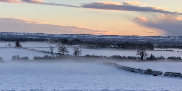
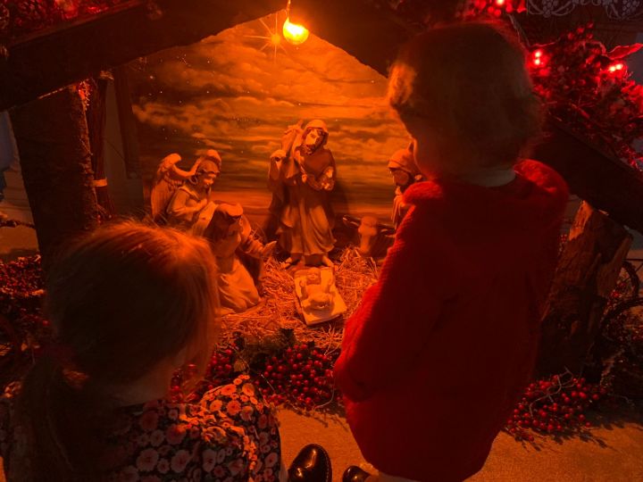
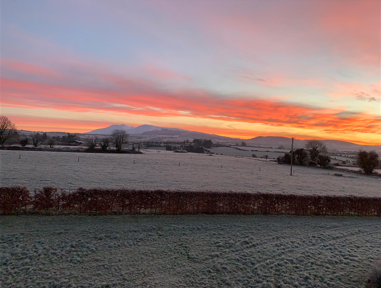
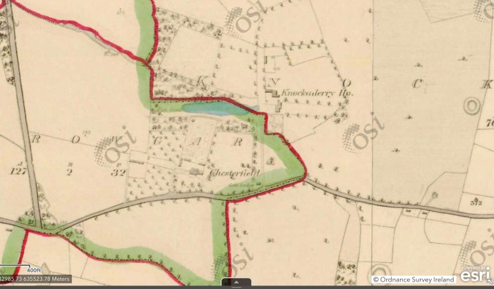

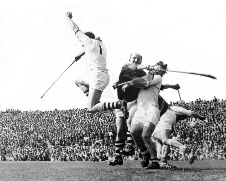


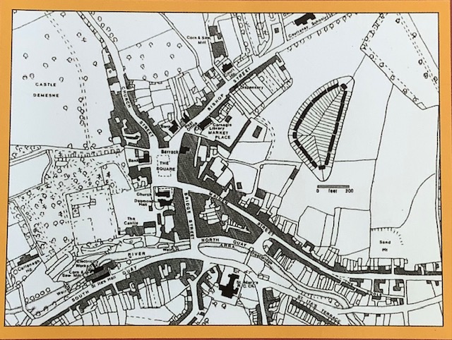

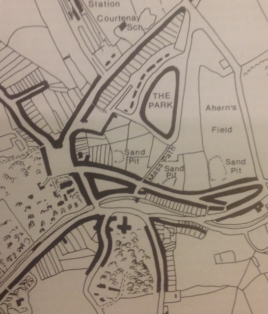

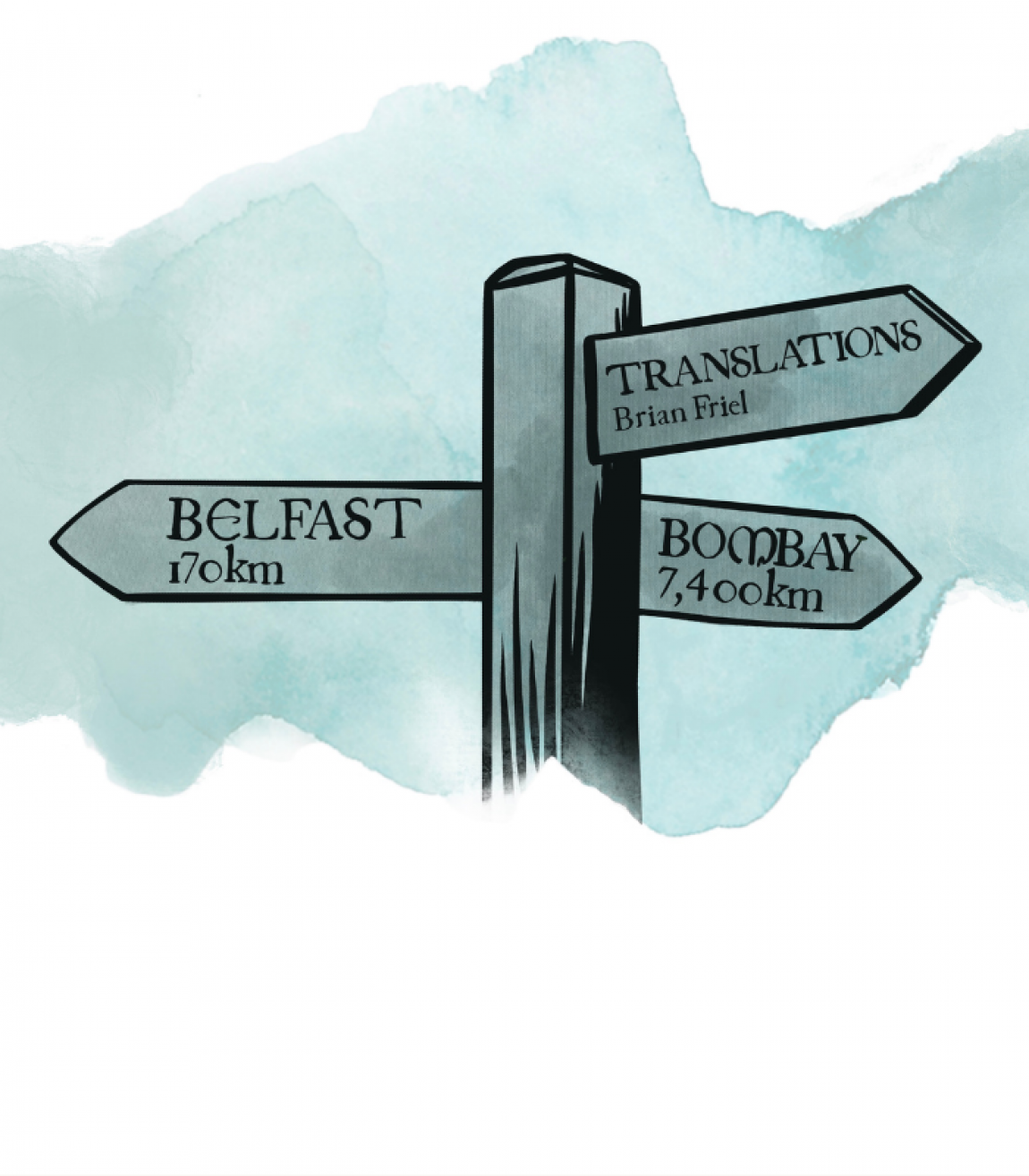 Translations is a three-act play by Irish playwright Brian Friel, written in 1980. It is set in Baile Beag (Ballybeg), in County Donegal which is probably loosely based on his beloved village of Glenties in West Donegal where Friel was a frequent visitor and where he is buried. It is the fictional village, created by Friel as a setting for several of his plays, including Dancing at Lughnasa, although there are many real places called Ballybeg throughout Ireland. Towns like Stradbally and Littleton were other variations and ‘translations’ of the very common original ‘Baile Beag’. In effect, in Friel’s plays, Ballybeg is Everytown.
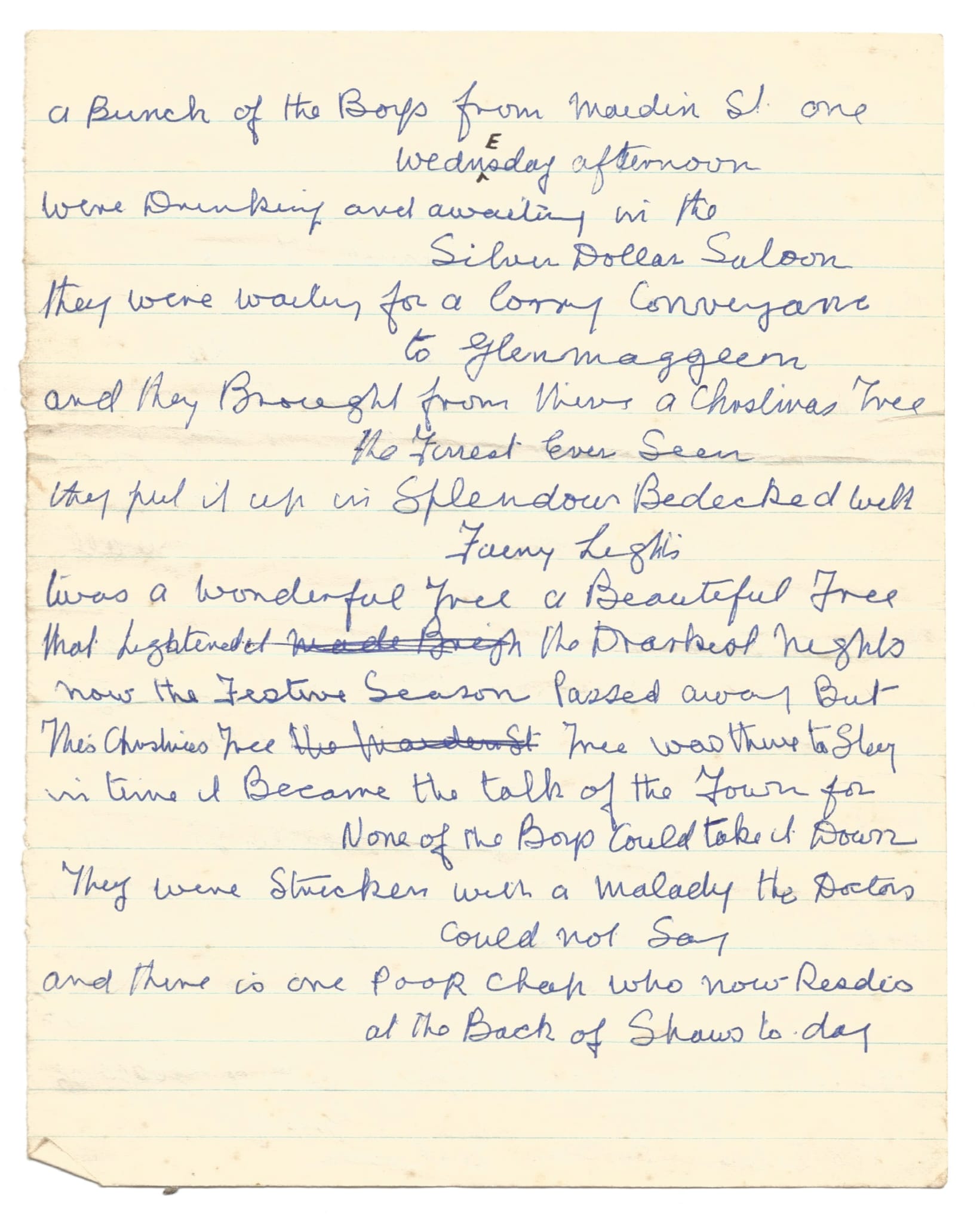


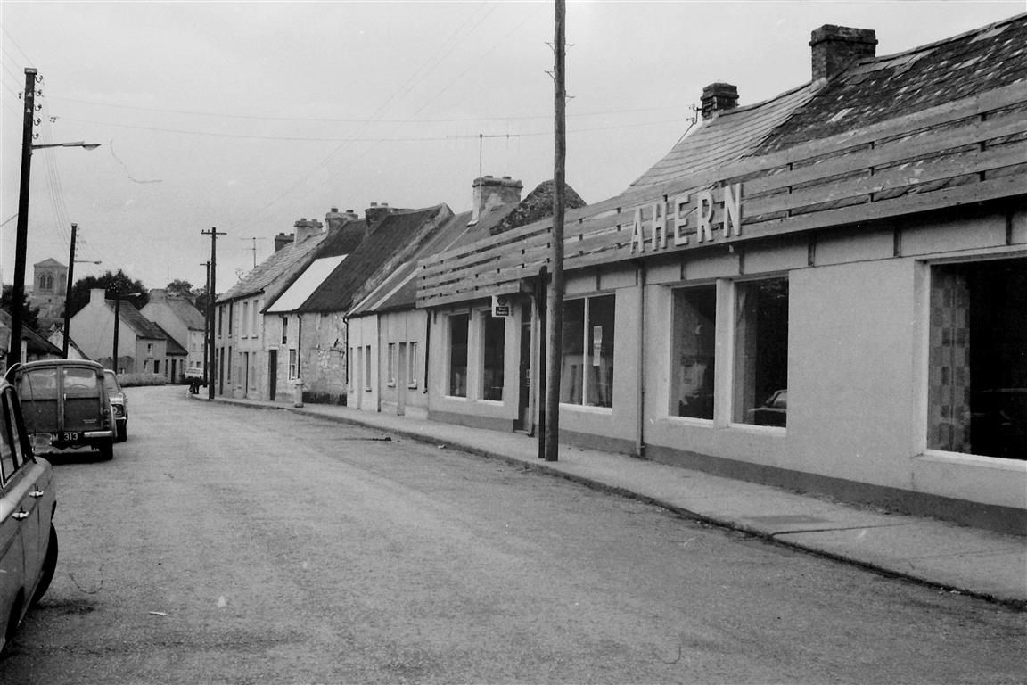


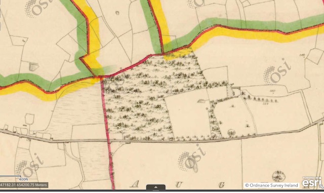


You must be logged in to post a comment.